- Group Tours Calendar
- Planning, Sightseeing & Routes
- Preparing for Ladakh Trip
- Stay, Eat, Permits & Others
- Taxis, Self-Drives & Bike Rentals
- Public Transport & Budget Travel
- Preparing for Spiti Valley Trip

Miyar Valley – the MOST COMPLETE guide
Miyar Valley, unknown to many – even in the most ardent Himalaya lovers’ circle, is a stunning little corner of the world. Given that it is extremely remote and mostly inaccessible, the valley hasn’t gained its fair share of following. Yet. Miyar has it all – limitless meadows, stunning carpets of unique flowers, glacial streams. Located in the north-west of the Lahaul district – Miyar covers over 100 KMs and is a beautiful amalgamation of landscapes of both Himachal and Ladakh!
Given its remoteness, this valley is accessible to those who trek! Since there are no defined routes, the treks can be as short as a day or two to as long as 10 days or more. The beauty is in the eye of the beholder as they say, and Miyar keeps unfolding into some of the most stunning, cascading views!
The locals like to refer to the valley as the “Valley of Flowers” and this trek will take you through grasslands, flower beds, mountain streams, moraine and boulders.

About Miyar Valley
Miyar Nala, as it is often known, is an exceptionally long S-shaped valley, which lies between Zanskar and Chamba. Covering a massive distance of nearly 100 KMs, with the Miyar River running into Chandra Bhaga River at Udaipur. This in itself covers over 50 kms distance from the Miyar Glacier. The glacier itself is nearly 36 km long all the way till Kang La (17,600 ft.) and beyond into the Zanskar Valley.
What’s beautiful is that a narrow gorge near the bottom of the valley is home to 12 little farming villages. All lying between 9,300 and 11,500 ft., with about 3,000 current inhabitants in total. The villagers are mostly of Buddhist faith and, thus, you’ll come across small Gompas (the one in Urgos is stunning!)
Locals of Miyar Valley
Cultivation of peas and grains, the main occupation in these villages – ceases at about 12,000 ft. Post this, you’ll be greeted by the most surreal of meadows! What boggled my mind, particularly, was a cricket field here! Isn’t the love for cricket in our nation beyond all belief? No matter where you are, no matter what you’re doing – if there is a field large enough – it will be converted into a cricket ground. So special! Oh I must mention, though a bit unnecessarily, that the views from the cricket ground are exceptionally jaw-dropping. With nearly 15 snow covered peaks visible at all times, you’ll be hard pressed to move forward!
Geography of Miyar Valley
The Valley is unique, it has some of the most beautiful landscapes and the presence of high-altitude Himalayan flora just adds to the magic. Along with the flora, you’ll be mesmerized by the meadows and the steep rocky side valleys. It almost becomes a game, a task to look for the beautiful flowers and wonder what they can be used for (a lot of these plants have medicinal purposes!)
Near the snout of the Miyar Glacier, at Phalpu, you’ll be welcomed into the Kesariyong Chu, seven icy sacred pools. These pools are highly revered in the Buddhist culture and you are allowed to bathe/dip in them for prosperity and prayers. On all sides snow-covered peaks abound, many of them unclimbed.
Thriving Flora and Fauna of the region
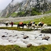
This is a huge selling point for me. To get to experience stunning, unseen, thriving vegetation is such a blessing! The journey will have you witness Juniper trees, Willow, Pine, Cedars, birch, Alder, Poplar trees along with some exceptionally colorful Orchids. In the summer and post-summer months, you’ll get to hear and spot many a migratory bird as well! I encourage you to interact with the local shepherds (gaddi) – they can share insights on the medicinal properties and help you recognize some of the herbs you’ll see. If you’re lucky, they will also share stories of how leopards attacked sheep in the recent times and other such folklore, synonymous with the nomadic life. Keep your eyes peeled for the blue sheep near Zardong.
A confluence of rivers and farming villages
What is surreal about this region, of course, is that the Miyar river forms an integral part of life here. Obviously. However, the confluence with the Chandra Bhaga river near Udaipr is an important pilgrimage in Lahaul. Further, revered peaks of Never seen Tower and Castle Peak are within a 2 km radius from the Miyar Glacier.
Introduction to the Miyar Valley TREK
The Trek in itself begins right after Udaipur in Lahaul. You reach the stunning, untouched, unexplored village of Shukto and then the magic awaits. The trail will take you through some of the most unbelievable views and terrains of Central Himalayas.
When in the valley, you will get to witness flora and fauna in all their natural glory! Wildlife here includes snow leopards, Himalayan bears as well as many flocks of migratory birds. Rocks akin to ruby and sapphire, crystal green glacial lakes are all awaiting you to visit.
The route in general will take you through vast meadows well above plantation levels, adjacent to rivers, grasslands and glacial streams. Combine this with sleeping underneath the stars in idyllic locations. Some of the key features of this trek include –
Multiples of River Crossings and boulder patches
An extremely thrilling addition, setting this unknown trek apart from most, is the multiples of river crossings! Throughout our journey, you’ll cross many a wooden bridge, with the Miyar river flowing beneath you in full force. Now if that is not a feeling of full living, I don’t know what is! There are two sections, in particular, where there are no bridges – you’ll be crossing the river itself. Not to fret, it is manageable, just keep your wits about you!
Rare Mountain Views
Since not many people are aware of the Miyar Valley , even in the trekkers’ circle, a lot of the views are uncaptured still. Rarely seen mountains such as the Menthosa Peak, Tharang I, II, III and the castle peak will be your accompaniments.
Best time to visit Miyar Valley
June to October is the best time to visit the area and embark upon the trek. The weather is supportive, the journey is easier and you’ll have access to more of the area. Winter months are a no-go as the entire region is covered in a thick blanket of snow.
The Route for Miyar Valley Trek
The route is scenic and will take you through some stunning routes. In essence, you’ll be covering the following journey.
Shukto – Khanjar – Thanpattan – Gumba – Zardung – Kesar Yon Chhap – Phalpu – Zardung – Gumba – Khanjar – Shukto
The Miyar Valley Trek – Brief itinerary
- Day 0 : Reach Manali
- Day 1 : Drive from Manali (6,725 ft.) to Udaipur (9000 ft.) Distance – 110 Kms, Total Time taken – 3 hours (via Atal Tunnel) Acclimatization Day.
- Day 2 : Drive from Udaipur (9000 ft.) to Shukto. Trek to Doksa (12080 ft.) Drive Distance – 22 km, Time Taken- 50 minutes, Trek Distance – 2 km, time taken – 1.5 hours
- Day 3 : Doksa (12080 ft.) to Yoling (12,388 ft.) Trek distance: 7.5 km, Time Taken – 5 hours
- Day 4 : Yoling (12,388 ft.) to Zardong (12,782 ft.) Trek distance – 12 km, time taken – 6-7 hours
- Day 5 : Zardong (12,782 ft.) to Phalpu (13,008 ft.) Trek distance – 7 km, time taken – 3-4 hours
- Day 6 : Phalpu (13,008 ft.) to Gumba (12,732 ft.) via Miyar glacier snout (14,599 ft.) Trek distance – 15 km, Time taken – 7-8 hours
- Day 7 : Gumba (12,732 ft.) to Doksa (12080 ft.) Trek distance – 12 km, Time taken – 7-8 hours
- Day 8: Doksa (12080 ft.) to Shukto (11400 ft.). Drive from Shukto to Manali Trek distance – 2 km, Time taken – 1 hour, Drive distance: 150 km, time taken – 5 hours
- Day 9 : Return home!
Detailed Itinerary for Miyar Valley Trek
Combined with above, here’s a detailed description of what to expect when you’re out in the Miyar Valley!
Day 1: Reaching Udaipur from Manali
The journey is slightly modified now, thanks to the Atal Tunnel. I have covered an e xtensive guide on Lahaul Valley and important things to cover previously, so I will refrain from discussing the route too much. One thing I want to highlight here is that you’ll see a stark change in the terrain and landscapes as you cross the Atal Tunnel!
A beautiful highlight will, of course, be the Sissu waterfall. Also, Tandi is an important point in your trip to fill up on fuel. From Tandi, you’ll take the diversion towards Udaipur.
Spend the night in Udaipur, acclimatize and relax. Enjoy the thrilling joy of being in a secluded valley!
Day 2: Head towards Shukto, then trek to Doksa
Shukto is the last stop on road. Once you reach Shukto, you’re starting your journey off in earnest! From the village, you’ll cross a suspension bridge to enter the village of Kanjer, roughly 30 Kms from Udaipur. This village will mesmerize you no bounds. With cultivation only occurring from June to September, you’ll be awed by the sheer will and hard work of the villagers. Crops include – iceberg lettuce, seed potatoes, apples, sea buckthorns, cauliflowers, barley, asafetida, and some medicinal plants including Kuth (Saucerrea lappa), mannu (Innu Racemosa).
After you cross the village, your trail will take you through many a farms all the way up to your first campsite on the journey – Doksa. This place is a slice of heaven. What’s wonderful is coming across the meadow-cum-cricket-field that is often used by locals. The mountains are also particularly disposed to rock-climbers, given the steep rock-faces. Spend the night here, where your view includes staring in Menthosa – the second highest peak of Lahaul and the crown of Miyar Valley!
Day 3: Journey on to Yoling
The trail today will take you through multiple villages and farms. You get to cross a river bridge as well! Initially you’ll descend and get to the bridge. After these, a series of descends and ascends takes you through a well-defined path. You’ll be crossing a Stupa today, for which the climb might be steeper, but only for about half an hour. After you cross the Stupa you’re in Thanpattan. From here on out, you’ll be on fairly easy trekking, with flat meadows surrounded by stunning views.
Today’s journey is stunning, with multiple sections of stunning flowers, all of different hues. Particularly beautiful is the path post Tharang massif where you’ll spot a beautiful growth of purple fleece flowers – aka Lupins!
Your stay for the night is Yoling, which has a water crossing nearby, adding to the eclectic charm. I hope you get a clear evening when here- because the sunsets just paint different colors across the mountains for hours on end!

Day 4: Head on to Zardong
About 7 Kms of overall distance to be covered today, with a very level walk and then a steep climb for about half hour. Today you’ll be experiencing an undulating boulder section, followed by an open valley with the views of Miyar River!
The day, overall, is a bit challenging, though, it starts off easy. After a levelled walk of about 15 minutes, you will be descending for the same time to reach a bridge. Upon crossing the bridge, there is a steep climb to reach the Gompa. A little way ahead, you’ll come across a hut, very close to the Gompa lake. Fill up your water supplies here. After the shepherd’s hut, you will be descending to some respite of a flat meadow patch.
But, the route ahead has some trickiness, requiring presence of mind. You reach a section of boulders, which will take you through multiples of ascends and descends, walking over edges in certain places. This particular patch is tiring, for sure. Eventually, you’ll reach the river, which feels like a well-earned, well deserved ease! Almost beach like with sandy shores of the river, and walking right along the gushing water – you’ll be making headway into the valley. The more you walk, the wider the river gets, majestic it becomes! To add beauty atop exquisiteness – you’ll be blessed with bountiful of flowers
Sleeping at the most exquisite campsites
The entire day will have you surrounded by flowers abound! The gradient change is not too heavy on the body and you’ll be ascending gradually throughout the day. The carpet of flower, however, will be a definite headline and a memory you won’t soon forget! Enroute today, you’ll be crossing the Gumba Nala, from where you’ll continue to follow the Miyar Nalla (by taking a north-west turn). Home for the night is Zardung – another show-stopper campsite. I can’t say this enough, but, the night skies from here will not let you sleep and you will be in a Zen-like stance for most of the night! The entire day, the colors, the visuals and the experience in itself is enough to leave even the most accomplished Yogis spellbound!
Day 5: Move from the stunning beauty of Zardong to Phalpu
Covering a mighty distance of 15 KMs today, the trail, thankfully, is a level walk by the steam. However, you will be crossing a few patches with many massive boulders. One of the most iconic places enroute today is Chhudong, which is a massive meadow. And, to top off the beauty – this patch is right next to the river. Though the day is long and never-ending, I would definitely spend some time here, soak in the views and remember the moment of belonging! The river in itself, is wider than anywhere else on the trek and the feeling is especially restful!
Due to the active river running right through the valley, the easiest route for this trek is alongside the river itself. This makes the route well-marked and easily noticeable – keeping you fairly safe! After you’ve had your fill of your heart’s desire of Chhudong, the gorge embraces you through boulder reinforcements. Subsequently, you’ll be on flatter grounds again and begin your rendezvous with the river! This will again be followed by a tiring journey through the boulders with an added challenge of some water streams. Your home for the night is Phalpu, located near Castle peak. Another very beautiful campsite with some gorgeous views of Tharang Peaks as well as the Menthosa peak.
Day 6: Phalpu to Gumba via Miyar glacier snout
The day is finally here, you’ll be touching the glacier snout! The journey is a bit laborious and moderately difficult, though, not unmanageable. After about 5 days of walking deep in the hills, you’ll be well prepared for the route. Key highlights include crossing 3 icy-cold river crossings along with the now staple patches of boulders.
Covering a total distance of 12 Kms is still mammoth. Though, not as challenging as your previous day on the trail, this is the epitome of your journey! After you get to the snout, I highly recommend spending quality time here to marvel at the stunning beauty of being in the vicinity of a glacier, with almost no one around. The last meadow on your journey is located about 30 minutes from the snout, near the seven icy ponds – Kesar Yon Chu. This is also the spot where the glacier begins.
Your return is from the same route, whereupon you’ll be crossing two more river crossings. Post Chhudong, you’ll touch a tricky spot with multiple boulders to manage. Then you reach your final campsite for the journey. Your vantage point today allows you views of both sides of the valley. Pure bliss.

Day 7: Gumba to Doksa
The return journey has finally begun. The end of a trek is usually so bittersweet. It is akin to gaining so much, yet not having absorbed all the changes in you, all the additions! Yet, the feeling of leaving a part of you behind is so strong!
The journey is quite dramatic today and it will definitely be easier and you’ll be in a trance like state for the most part! Enjoy your final night at Doksa.
Day 8: Doksa to Shukto. Drive from Shukto to Manali
Only 2 KMs on foot and you’re back in Shukto. From here, head on back to Manali and enjoy re-adjusting to being surrounded by civilization!
- I highly recommend keeping a buffer day (or two) handy. This can come in handy if the weather is not that great for you to embark on a leg of your trek. If not used, you can always enjoy spending a couple of days at the end of the trip in Manali and enjoy all it has to offer.
- The trek can be done solo. The route is fairly well defined. However, this is only so for seasoned trekkers with an exceptional understanding of routes and paths in the Himalayas. If you’re new to the hills, I highly recommend getting a local guide to accompany you. Also, this is especially helpful to ensure you have access to sufficient food and supplies.
- There is no electricity throughout the trek, obviously! The only place you’ll find a plug to charge your phone or camera batteries will be Udaipur (in Himachal Pradesh) before and after the trek. So, use your electronic equipment wisely! Do remember, the batteries drain faster in colder weather! Keep backup power banks!

It is hard to imagine a place so untouched by humans. With no one around, there is a sense of belonging that not many have felt before. As a lover of the hills, I can’t tell you of the sheer joy you’ll experience in this valley.

Shefali spends most of her time day dreaming about her next big vacation. A happy-go-lucky personality, she is an amalgamation of all the places she’s lived in and experienced! She is always confused as to where to call home, having lived in Chandigarh, Shimla, Dehradun, Mumbai, Hyderabad in India and Vancouver, Abbotsford in Canada. Her love for travel is only challenged by her love for reading and eating delicious food! In order to sustain her dreams, she brought out her inner geek, got an MBA and has a job in the corporate world crunching numbers. Do follow @notravelplans on Instagram for updates on her next great adventure.
Related Posts
Srinagar leh highway status 2024 – 2025, the courtyard hostel in leh – bunks, beds & rooms for bikers, manali leh highway status 2023 – 2024.
Comments are closed.
Type above and press Enter to search. Press Esc to cancel.
Privacy Overview
Ad blocker enabled.

Miyar Valley Trek
- + 5% Goods & Service Tax
- Transport Included | Manali To Manali
- ₹ 15,450 Is Trek Fee | ₹ 3,000 For Transport (All Included In Trek Fee)
- Call Now: 7055332966

- Basecamp Udaipur, Lahul
- Pick & Drop Point Govt Bus Stand Manali
- Trek Grade Moderate
- Trek Duration 8 Days
- Highest Altitude 14,599 ft
- Trek Distance 63 Kms
Miyar is an extremely remote and difficult to reach valley in the western corner of the large district Lahaul and Spiti in the Indian state of Himachal Pradesh. Miyar Nala is a long valley. The Miyar River runs down into Udaipur’s Chandra Bhaga River, more than 50 kilometers below the Miyar Glacier. The glacier extends 24km further up to Kang La Jot (5468m), and beyond to Zanskar valley, Ladakh. The Miyar Nala, which is located at the bottom end of the valley, widens to provide support for twelve small farming communities at an altitude between 9,300 and 11,500 feet. There are approximately 3,000 people currently living in the area. The majority of Nala’s inhabitants are Buddhists. There is also a small monastery in Urgos. The valley is nearly 12,000ft high, and the cultivation of peas and grains ceases. This is where the stunning Himalayan meadows start. Gaddis, a shepherd tribe, graze their flocks here in the late summer. The popular high-altitude cricket ground offers breathtaking views of 15 to 20 snow-covered peaks. You will find the full range of Himalayan high altitude flora in the meadows as well as the side valleys with steep rocks. It can be quite difficult to find. The bottom of the Miyar Glacier is Phalpu. Here, the brave can take a dip in Kesariyong Chu. These seven sacred pools are icy. Many unclimbed peaks are surrounded by snow. The Chhudong Valley is home to some of the most stunning and jagged peaks. These can be seen only after a strenuous hike up the side valley to Phalpu’s dominant Castle Peak. Then, perhaps, a climb up the amazing Chhudong/Tawa Glacier up to Neverseen Tower at almost 6,000m. The trek to Kang La (pass), which starts in Miyar Valley, involves crossing the Miyar glacier for 24 km and climbing up to 5450m. This pass is the way to cross into the Zanskar Valley, which lies north-east of the Great Himalayan range.
A valley dotted with flowers lies in the remote Lahaul region, and is hidden from the prying eyes of trekkers. This valley is reached by a combination of remote mountain valleys, small villages, and flower beds that are dominated with Himalayan orchids. This is Miyar Valley.
The Miyar Valley Trek begins from Udaipur, Lahaul in Himachal Pradesh. The trail begins at Shukto, a village in the beautiful Miyar Valley, which is known as the Yosemite the Himalaya. It is a flat, easy walk through some of the most stunning landscapes in Central Himalaya. Miyar valley is home to medicinal plants, herbs, wildlife such as the Himalayan brown bear and snow leopard, along with migratory birds and sapphire- and ruby-encrusted rocks and seven glacial lakes. The Miyar River leads us through vast fields of wildflowers and cold glacial streams to Kesar Yon Chhaap. This idyllic campsite is located near the Miyar glacier’s 24 km length, surrounded with hidden lakes. Miyar Valley is best explored between May and June and September to October.
How difficult is the Miyar Valley Trek?
Miyar Valley Trek is an option Moderate trek on a difficulty scale ranging from easy-to-difficult.
Manali, at 6,725 feet above sea level, is the starting point. In 8 days you will reach 14,599 feet.
It is a pleasant hike through the valley for the most part.
As you get closer to the pass, however, the terrain becomes more difficult. It takes almost nine hours to cross the pass.
The trek is moderate because of this. This trek is suitable for first-timers who are fit.
For this trek, you will need to prepare for at least four weeks. Start your preparation by taking brisk walks, then jogs to increase cardio. You should aim to complete 5km in 37 minutes by the time you reach the end of the trek.
Day Wise Detailed Itinerary
Day 1 – drive from manali-udaipur (acclimatization day)..
Duration: 3 hours (via Atal Tunnel) The vehicle can be shared by trekkers. Reach Udaipur before 4 pm
Atal Tunnel is the only way to go from Manali to Shukto. The dramatic changes in climate, terrain, and landscapes are obvious. Lahaul is known for its mystic beauty.
You can see famous sights from the window, such as Triloknath mandir (“At Tunde”) and Tandi (where you will find the confluence between the rivers Chandra & Bhaga).
It is easy to see the stark contrast in Himachal’s Lahaul and Kullu regions. The Atal tunnel allows you to enter two worlds by going through it. You drive alongside the Chenab river, passing through steeply folded mountains and loose sedimentary rocks sections.
These fields are worth noticing. Lahaul’s local farmers grow iceberg lettuce and other food crops.
Sissu’s waterfalls are the most stunning part of the road trip. Tandi is the point where the road turns to go to Leh Manali highway or Udaipur. Tandi is also where Chandra and Bhaga confluence, which is why it is called the “City of Two Rivers”.
Before 1695, Udaipur was called Margul. It is the headquarters of Lahaul’s sub-divisional headquarters. The name comes from Raja Udai Singh Chamba. Triloknath Temple and Margul Devi Temple are two of the most famous landmarks in Udaipur.
Day 2 – Drive from Udaipur, to Shukto. Trek to Doksa
Drive distance: 21.6 km | Duration: 50 minutes Duration: 1-1.5 hours Gain in altitude: 9,000 to 12,080 feet
Shukto is the end of the road. To enter Kanjer village, cross the suspension bridge suspended above Miyar Nala. This village is the end of the route. It is located 31 km from Udaipur. This valley is home to 13 villages.
Three types of soils are found in this region: Alluvial and Hill type. Only June through September is the best time to cultivate in this region. Most of the villagers grow iceberg lettuce and seed potatoes, tomatoes, sea buckthorns. They also have a variety of medicinal plants like Kuth (Saucerrea lapa), Mannu (Innu Racemosa).
The trail begins here in a series switchbacks, with farms along the way to Doksa. The area is said to have a beautiful stream of water nearby. Locals also use the flat meadow to play cricket occasionally.
This region is also home to many steep rockfaces, which have attracted rock-climbers’ attention.
Doksa campsite’s best feature is the view of Menthosa, Lahaul’s second highest and most beautiful peak. It is also known as the crowning jewel of Miyar valley.
Day 3 – Doksa to Yoling
Duration: 5-5 hours Altitude Gain: 12,080 to 12,388 Feet Type of trail: This ride takes you through a village with farmlands along the route. You will cross a river bridge, and you’ll also find a cricket field.
You will start the trail by going down and then cross a bridge. The trail will then descend, and you’ll be crossing Juniper trees. For the most part, the trail is well-defined. You will descend into a valley with juniper shrubs. For about 20 minutes, you will descend a steeply towards the stupa. Thanpattan is the name of the region that starts from stupa.
The majority of the area is made up flat meadows that are surrounded by rocky mountains. The trail passes Tharang basecamp. Tharang is a Massif that has tree mountain tops, which can be clearly seen when looking backwards from Zardong. You will pass a section of purple fleece flowers, also known as Lupins.
You will see different phases on the trail.
Yoling is near a forest house. It is situated in an area that is flat and has a stream running by. Evenings that are clearer will see the mountains change their color phases. It is a great place to play games.
Day 4- Yoling to Zardong
Duration: 6-7 hours Altitude Gain: 12,388 to 12,782 feet Type of trail: The trail starts with a descent and then climbs up to Stupa. The trail becomes gradual after that. The landscape changes frequently in colour.
You will start the trail by going down and then cross a bridge. The trail will then descend, and you’ll be crossing Juniper trees. For the most part, the trail is well-defined. You will descend into a valley filled with juniper shrubs. Next, you will descend a steep portion towards the stupa, which takes about 20 minutes. Thanpattan is the name of the region that starts from stupa. This region is dominated by flat meadows and rocky mountains. The trail passes Tharang basecamp. Tharang is a Massif that has tree mountain tops, which can be clearly seen when looking backwards from Zardong. You will pass a section of purple fleece flowers, also known as Lupins.
There are phases with different colors along the trail. Yoling is near a forest house. It is situated in an area that is flat and has a stream running by. Evenings that are clearer will see the mountains change their color phases. It is a great place to play games.
Day 5 – Zardong to Palpu
Duration: 3-4 hours Altitude Gain: 12,782 to 13,008 Feet Type of trail: This hike starts with a level walk and then takes 20 minutes to climb up to Gompa Nala. It leads into an undulating section of boulders, then descends into a flat valley with flowing Miyar Nala.
This is the most difficult day of the entire trek. The trek starts as a flat walk, and then descends 10-15 minutes to the bridge. The bridge is followed by a steep climb for 20 minutes towards Gompa. To the right, Gompa Nala is also visible. You will see a shepherd’s house and a small body of water around, also known as Gompa Lake.
The route descends gradually towards a meadow patch after you have walked 30 minutes from the shepherd’s house. The route continues uphill to a boulder section. This section is a bit tricky as you may be crossing the edges at some points. It can be tiring to walk up and down boulder sections. The surrounding mountains are steep and majestic. The route eventually descends to a flat area alongside the river. Here you can enjoy the endless gushing water and beach-style walks. The valley becomes larger and more grand as you go inwards. There are always valley openings. There are many types of flowers along the trail. From a distance, you’ll notice a meadow that is surrounded by large boulders. This is Zardong. Zardong is situated in an area surrounded by Boulders. It is surrounded by stunning views.
Day 6 – Palpu to Gompa via Miyar glacier nose
Duration: 7-8 hours Altitude Gain: 130008 feet to 14,599 foot to 12,732ft Type of trail: A level walk along the stream. There are a few boulders scattered throughout the trail.
You will walk alongside the river. The majority of the route is flat. The region is known as Chhudong. The river is right beside Chhudong, which is a large meadow. This river is much more tranquil and wide than any other on the trek. The murky water to your right reaches the nose. The valley is surrounded by an active river. It’s easy to walk along the river, which is clearly marked and easily visible. The valley is crammed with boulders after the flat meadows at Chhudong. You will then be greeted by a cold stream that flows from the valley. The Stream is also from the same valley as Castle Peak and Never Seen Tower. The trail becomes more gentle and you can walk right next to the river. Once again, the trail becomes more flat and you will need to negotiate boulder patches that have few water streams. Palpu is near Castle peak, which is another beautiful campsite with a great view of the valley. If the weather is good, you can also see Menthosa from here.
Day 7 – Gompa to Doksa
Duration: 7-8 hours Altitude loss: 12,732 to 11,400 feet Type of trail: Moderately difficult. Boulder patches close to Kesar Yon Chu or Gompa The steep climb between Zardong & Gompa is quite strenuous. Today, you can also cross 3 icy-cold rivers.
This day, we’ll be going to the snout glacier. After passing through a section of boulders and a stream, you eventually reach a small meadow area near seven icy lakes. This place is called Kesar Yon Chu. The actual glacier begins from here. Only 30 minutes from the ponds is the snout.
Spend some time once you reach the snout. You can then return to the beginning by following the same route. On the return, there are two additional river crossings.
The region around Chhudong is flat, and you can walk alongside the river. The tricky part until Gompa is next. Multiple times you will ascend and descend. You will finally reach Gompa Nala.
The trek is over. You can see both sides from the vantage point.
Day 8 – Doksa to Shukto Drive from Shukto To Manali
Duration: 1 hour Altitude loss: 12,080 to 11,400 feet Type of trail: Easy. Walk of a short distance.
Duration: 5 hours The vehicle can be shared by trekkers. Manali can be reached by 2 p.m.
The Thanpattan area is beautiful, and it looks exactly like Clint Eastwood’s movies. It’s flat walking for miles. It is quite impressive to walk back.
- Short Itinerary
Day 1 :- Drive from Manali-Udaipur (Acclimatization Day).
Duration: 3 hours (via Atal Tunnel) The vehicle can be shared by trekkers.
Day 2 :- Drive from Udaipur, to Shukto. Trek to Doksa
Drive distance: 21.6 km | Duration: 50 minutes Duration: 1-1.5 hours
Gain in altitude: 9,000 to 12,080 feet
Day 3 :- Doksa to Yoling
Duration: 5-5 hours
Altitude Gain: 12,080 to 12,388 Feet
Day 4:- Yoling to Zardong
Duration: 6-7 hours
Altitude Gain: 12,388 to 12,782 feet
Day 5 :- Zardong to Palpu
Duration: 3-4 hours Altitude Gain: 12,782 to 13,008 Feet
Day 6 :- Palpu to Gompa via Miyar glacier nose
Duration: 7-8 hours Altitude Gain: 130008 feet to 14,599 foot to 12,732ft
Day 7 :- Gompa to Doksa
Duration: 7-8 hours Altitude loss: 12,732 to 11,400 feet
Day 8 :- Doksa to Shukto Drive from Shukto To Manali
Duration: 1 hour Altitude loss: 12,080 to 11,400 feet Duration: 5 hours The vehicle can be shared by trekkers.
Manali can be reached by 2 p.m.
Trek Cost Inclusion
Stay is included on all days of the trek ( from Udaipur to Shukto ).
At Udaipur saty will be in guesthouse.
You will be staying in tents (2 per tent).
All meals from dinner at Sankari on Day 1 to breakfast on Day 8 are included. Meals are simple, nutritious and vegetarian.
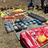
All the trek equipment will be included like a sleeping bag, kitchen & dining tent, utensils, mattress, tent, toilet tent, and crampon (if needed).
Note:- Tents and sleeping bags are custom made of Trekup India which are tested on high altitudes by our mountain expert trek team.
First aid medical kits, oxygen cylinder as well as stretcher.
Check our on trek safety protocol here.
All the needed forest entry fees along with permits.
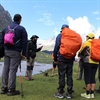
Your trek will be led by a trained , experienced professional guides and trek leaders with a solid guiding background , times of particular nature and trekking experience , medical certifications , and a passion for leading people into breathtaking terrains .
Transport charges from Manali to Udaipur and Return from Shukto to Manali.
Trek Cost Exclusion
- All kinds of personal expenditures are excluded.
- Anything that we have not mentioned avobe.
The trek cost is not inclusive of meals bought during the journey on 1st day and last day. ( Food starts from dinner at base camp on day first till last day lunch ).
Mules or porter charges to carry private baggage (Offload Charges for bag 800 per day, per bag. Note: bag weight should not be more than 11 kg.
Any kind of emergency evacuation charges
Trek Logistics
Pickup point will be Manali bus station and pickup time will be 11.30 P.M.
Note: We will share exact pickup location and driver details on whatsapp group, apart from it our transport manager will be also present at the pickup point to assist you.
We will drop you off at govt bus station max by 5 P.M on the final day. We advice you to make your departure bookings after 8 P.M.
Availability
To book please click on date below.

How To Reach Manali?
We are delighted to see that you have chosen the Miyar Valley Trek. It is one of the most spectacular crossover treks in all of the Himalayas. It is an amazing trek, but you must make sure your travel plans are in order.
A quick overview of how to plan your trip
Day zero (the day prior to Day 1): Book your flight to Chandigarh. If Chandigarh proceed to Sector 43 to take a bus to Manali. Book an overnight bus from Delhi to Manali if you are in Delhi.
Day 1: Manali-Udaipur (9,000 ft drive)
You need to report to our base camp at 11.00 am. After registration, lunch will be served. Then you will proceed to Udaipur. Cost per vehicle – Tempo Traveller: Rs 8,000, Sumo Rs 6,500. These costs are not included in the trek fees. This is to be paid to the driver and shared with trekkers.
Day 2 – Day 7 Drive from Udaipur – Shukto – ( Trek the Miyar Valley Trail )
Day 8 – Shukto to Manali ; 6-7 hours driving. Manali is expected to be reached around 2.00 p.m. We recommend that you book your return to Manali after 8pm because of the monsoon conditions.
Day 9 Book return train/flight ticket from Chandigarh, Delhi, from Bhuntar.
Everyone must get to Manali at the beginning.There are three options to get to Manali
Option 1 :-
Travel overnight on a bus to manali.
Delhi to Manali 14 hours
Chandigarh to Manali 10 hours
A bus ride to Chandigarh is the most convenient choice.
We would always suggest using the government. buses instead of those operated by private companies outside the bus station, in our experience, we’ve observed that there are a lot of likelihood of delays with private buses.
Additionally, government. buses are more trustworthy. Whatever bus you pick be sure to get to Manali at the very least between 9 and 10 am.
Fly to Delhi/Chandigarh airport, then travel via bus to Manali (Best alternative).
Fly to Bhuntar Airport. Manali is only two hours away. You can easily catch an airport bus or private taxi to the airport.
We do not recommend Bhuntar airport due to the pricey flight and the unpredictable nature due to cancellations. If you decide to fly via Bhuntar be sure to be there at least a day prior to when the trek begins.
It is possible to go by train. Pathankot railway station which you can take bus services that direct you to Manali which is about 300 kilometers from the station and will require an overnight trip. If you do this it is best to arrive one day prior at Manali.
When you arrive at the point of assembly for the trek to Manali. Trekup India will handle your journey up to Jobra, Chatru to Manali and an excursion to Chandratal.
Make sure that you arrive at Manali before 10:30 am in the initial day of the program so you’re able to get to the place of assembly before noon.
Things To Carry for the Miyar Valley Trek?
1. trekking shoes, 2. backpack, 3. clothing, 5. insulation layers in winter., 6. two – trek pants, 1. sunglasses., 3.hand gloves., 4. woollen cap or balaclava., 5. socks (3 sets)., 6. head torch / head lamp, 7. trekking pole / trekking stick, 8. rainwear., 9. rain cover for your backpack ., 10. daypack (20-30 ltrs, optional)., additional necessary trek essentials, 1. a toilet kit., 2. cutlery:, 3. two one litre plastic bottles or even a two litre hydration pack:, 4. presonal medi kit, compulsory documents to carry., food provided by us during the miyar valley trek.
We provide only Indian vegetarian food and mainly your meal is going to contain Indian bread, vegetable, lentils and Rice along with delicious dessert. During your trek, we will serve three meals a day including breakfast, lunch, and dinner .
In the evening, you will also be served tea & snacks and lip-smacking soup before dinner. If it will be a long day of trekking, you will be given a packed snack.
After doing a lot of research on the nutritional requirements for the trekkers, we prepare the menu. Before putting all the meals together, we also consider altitude gained and weather.
The meal served by us while trek is perfectly balanced with the right amounts of calories, carbohydrates, vitamins, protein, fiber, and minerals. You need to know that all our cooks have great expertise in cooking and have undergone thorough training. So, get ready to enjoy delectable and lip-smacking dishes during your trek.
You will be served with lemon tea in the tent in order to start your day with a refreshed feeling. Before leaving the campsite for trekking, you will be given a hot finger-licking breakfast like upma, Aallu Prantha, Besan Chilla, Poha, Daliya, Corn flakes, Maggie, along with tea or coffee.
In case, your trek will be longer one then we also offer some fresh local fruits such as apples and even healthy drinks like Frootie or Maaza. In the afternoon, you will be served simple & healthy lunch, while at around 04:00 pm, you will be given tea and a light evening breakfast.
After you reach your campsite at night, you will be served a hot and delightful dinner. After reading this, you must have got the idea about the food provided by us on trek, you don’t need to worry about food. Many trekkers trek with us again and again because of the food we provide. Thus, we will definitely give you unforgettable experiences.
Safety During Miyar Valley Trek
Trekking with us for Miyar Valley is completely safe because we have a team of trek leaders who are qualified in Wilderness first-aid and also have complete information about the high-altitude glitches.
During Trek, we carry a complete first-aid kit that contains all the important medicines. Before trekking with us, you need to ensure that you are medically fit for the trek and if you are able to judge yourself then it is better to take advice from a professional.
For us, your medical fitness is very important than anything else.
Know About Us:- You need to know that our company TrekUp India has been in the field of Adventure Tourism for the last 23 years. Right from our inception, we have been involved in providing treks, voyage & hiking programs as well as high altitude expedition rafting.
We keep on organizing treks in Uttarakhand and Himachal, while being a part of the trekking community, we feature more than 75 Himalayan documented treks. Apart from other outdoor activities, our company also organizes trips for schools, colleges, and family.
We ensure complete technical safety in the mountain
Our company has a vast team of more than 100 guides, as well as trainers in order, serve in the mountain treks.
One of the best things about our team is that all the members are trained professionally from Nehru Institute of Mountaineering, Indian mountaineering foundation Delhi as well as Hanifle Center Outdoor Education Mussoorie.
Therefore, we never believe in compromising on the quality as well as services offered to our valuable customers.
For Us, Your Safety Is the Top Priority
At Trekup India, you will find a team with local knowledge and fluency in English as well as Hindi. This helps in ensuring that you have an amazing trek and not only this, we also pay attention to your health as well as safety because this is something we cannot ignore.
All the team leaders involved in trekking have already undergone several professional courses in First Aid, Portable Altitude Chamber Training, CPR, Environmental Awareness Training as well as Advanced Wilderness Emergency Medicine.
We also carry a complete first aid medical kit not only on the trek but on each and every trip which is organized by us. Apart from the medical kit, we carry a portable altitude chamber and medical oxygen for all kinds of high-altitude treks .
Our company has great expertise in organizing all sorts of group adventure holidays for family groups, school & college groups as well as friend groups. When it comes to travel options, we have a wide range that suits different fitness levels as well as traveling styles.
Therefore, no matter who big the group size, we pay personal attention to each and every member present in the group.
How We Ensure That Your Trek Is Safe with Us
Right from our establishment, we at TrekUp India, are continuously involved in introducing new safety practices into Indian trekking in order to ensure the safety of voyagers.
For walking on snow, TrekUp India introduced Microspikes and also made emergency bottled oxygen mandatory for all kinds of treks.
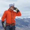
In order to test pulse as well as oxygen saturation levels, pulse oxymeters are used. As a safety communication device, we at TrekupIndia introduced radio.
Though we have noticed that most of the organizations organizing treks do not follow these systems but with time several competing companies are adopting these practices and organizing great and safe treks.
Explore our New Safety Protocols
In order to ensure a perfect Trek, we have introduced some new safety checks that will assure more safety for our trekkers. Our On-trek safety checks include:
- Daily oxygen saturation along with pulse readings
- Stretchers team appointed on every trek
- Trained mountain staff and full safety
- Additional oxygen cylinders
- Special medical kit for high altitude treks
- Microspikes on all types of snow treks
- Experienced Trek leaders as well as safety
- Technical team on all snowy slopes
- Detailed Itinerary
Trek Fee Inclusion
Dates available.
- Thinghs To Carry
How To Reach
- Food During Trek
- Safety During Trek
Full Itineary
Short itineary, things to carry, food on trek, other treks like kedarkantha.

BrahmatalTrek
- Region : Uttarakhand
- Duration : 6 Days
- Altitude : 12,250 ft
- Best Time : Dec, Feb

Har Ki Dun Trek
- Duration : 7 Days
- Altitude : 12,000 ft
- Best Time : May, June

Kauri Pass Trek
- Region :Uttarakhand
- Duration : 5 Days
- Altitude : 12,516 ft
- Best Time : Sep- June
Holi Splash Sale: Save upto 20% on summer adventures till 31st March!
Miyar Valley Trek
The Yosemite of the Himalayas
Holi Splash Sale✨
Enjoy up to 20% off on summer adventures this holi offer valid till 31st mar. discount available at checkout., available batches, brief description.

Brief Itinerary
Detailed itinerary.
Manali to Changut (10,500 ft) via Udaipur - 135 km Drive
We leave from Manali early morning and drive across the Rohtang Pass to Udaipur in the Chandrabhaga valley. From Udaipur, we turn north into the stunning Miyar valley to the small village of Changut. Overnight in Changut.
Changut to Manali via Udaipur - 135 km Drive
We will drive back via Atal tunnel to Manali, which we will reach late in the evening (around 4PM). The trip ends in Manali. Please keep a 2 hours gap in case you are booking a return bus from Manali on the same day.
What's Included
- Meals during the trek starting dinner on Day 1 till breakfast on Day 8
- Forest Permits/Camping Charges/Permits, Trek Permit Fee/IMF Permission (Upto the amount charged for Indian nationals)
- Camping tents, Sleeping bags, mattress
- Microspikes, gaiters, seat harness, carabiners, helmet as required
- Mountaineering course certified Trek Leader with Wilderness Emergency Responder
- Experienced Local guide, cook, helpers
- Porters or mules for carrying common luggage
What's Not Included
- Meals during road journeys
- Any kind of Insurance
- Any expense of personal nature
- Any expense not specified in the inclusion list
- Carriage of personal rucksack
Are you Eligible for this Adventure?
Max Altitude

BRS Level Required
Miyar Valley Trek is a level 4 adventure on the Bikat Rating Scale.
This makes it mandatory for you to have high-altitude experience of preferably multiple treks marked at level 5 on the BRS. The altitude, the terrain and the nature of the climb demand a certain level of skill and a need for you to be aware of how your body reacts to the various features of high altitude environment.
If you do not know what level of BRS trek would suit you best, worry not! Fill out this Form:

we will send you a progression chart to help you comfortably get out of your comfort zone in order to level up and ultimately reach your highest potential in the big, bad world of outdoor adventure.
Packing List
This is a list of essential items for individuals doing the trek with Bikat Adventures. This list contains only those items which the participants are required to bring with them. The list excludes those items which are provided by Bikat Adventures on the trek. We have divided the items into five categories. All the items in the list are essential except for those marked as optional.
Trekking Gear
- Ruck sack bag with rain cover. Qty -1
- Day Pack Bag - Recommended for treks with summit day
- Head Torch with spare Batteries. Qty -1
- U V protection sunglasses. Qty -1 Here is how you can choose the best sunglasses for trekking.
- Water Bottles: 2 bottles of 1 liter each
- Non-skid, deep treaded, high-ankle trekking shoes Qty -1
- Pair of light weight Slipper/Sandals Qty -1
- Quick Dry Warm lower or Track Pants. Qty - 2
- Full sleeves T-shirts/ Sweatshirts. 1 for every 2 days of trekking
- Pair of thick woolen socks. 1 pair for every two days of trekking
- Thermal Body warmer Upper & Lower. Qty-1
- Undergarments. Qty - 1 for every day of trekking
- Warm jacket closed at wrist & neck .Qty-1
- Full sleeves sweater. Qty -1
- Rain wear ( Jacket & Pants ) . Qty-1
- Pair of waterproof, warm gloves. Qty-1
- Woolen cap. Qty-1
- Sun shielding Hat. Qty -1
- Personal toiletries kit (Small Towel, Toilet paper, paper soap, Bar soap, toothbrush, toothpaste, cold cream, etc.)
- Sun screen lotion small pack. Qty -1 Here is your Sun Protection 101 to stay safe in the bright sunny outdoors.
- Lip Balm small pack. Qty-1
- Small size, Light weight & Leak proof lunch box. Qty-1
- Plate. Qty- 1
- Spoon.Qty-1
- Tea/Coffee (plastic) Mug.Qty-1
Miscellaneous
- Camera (Optional)
- Carry your medicines in plenty in case you have any specific ailment. Consult your doctor before joining the trek.
- Dry fruits, Nuts, Chocolate bars (Optional)
Frequently Asked Questions
Eligibility, is this adventure good for me, what’s a good fitness benchmark for this adventure, what skills do i need to complete this adventure, what is the minimum and maximum age limit, about the activity, where is it located, what are some of its highlights, what are some of its challenges, what is the best season for this, what is the accommodation type, what is the temperature like here, is it technically challenging, connectivity, how do i reach the starting point, is there cellular network available throughout, where is the nearest atm, if i choose to travel to the base with you, what is the pick-up point, what time is the drop-off on the last day, what are the nearby attractions that i can explore, equipment & gear, what equipment is provided to us, what can i rent from you, where will i receive the rented items, where do i have to return the rented items, what gear do i need to bring, are there local shops to rent/buy equipment, facilities & additional services, can i offload my bag, can i leave any extra luggage i carry at the base of this adventure, what are the meals like, what are the washroom/ toilet facilities like, what should i do if i get my period on this adventure, what are the medical facilities available to me on this adventure, are there any electricity charging points on this adventure, mandatory documents, what documents do i need to carry, do i need insurance for this, do i need a permit for this, certification, do you provide a certificate of completion, when and how will i get the certificate of completion, international travel, will i need a visa, when should i apply for the visa, what kinds of insurance do i need to travel here, what is the specialty of this when compared to other mountain ranges, till which month can i make a booking for this, what is the qualification of the outdoor leader provided to us, how do you choose your outdoor leaders, is it safe for women, what is the ratio of outdoor leader to participants, what do you do in case of an emergency, what are the rescue options on this adventure, how do you choose your equipment, can i attempt this adventure if i have a specific medical condition, sustainability, what kind of camping do you practice on your outdoor adventures, why are you against fixed camping in the outdoors, how do you manage overcrowding on certain trails, what are some things to remember when using a dry toilet, why should i avoid wet wipes in the outdoors, where should i dispose of my sanitary waste if i am on my period, why should i carry my own utensils on an outdoor adventure, booking process, what happens after i make the payment, do you create a whatsapp group of participants before the start date of the activity, do i need to submit a medical certificate, do i need to submit an undertaking form.
Small Group Size
Our batch sizes are capped at 15 for smaller treks with the trek leader and trekker ratio of 1:8. This ratio, in our years of experience, has proven to deliver the best trekking experience for individuals as well as groups. Capping the size of the group ensures individual attention to each trekker so that no signs of distress or need during the trek go unnoticed. It also helps to form a more cohesive cohort with better group energy which helps define the rhythm and pace of days on the trek. As you go higher up on the BRS scale, since the stakes are higher, expeditions have an even smaller group size with the ratio of expedition leader to climber set at 1:2.
Qualified Trek Leaders
We follow a rigorous regime of hiring and training our experts in the field. Each trek leader is a certified mountaineer with years of experience in the field. In addition to their qualification, they also go through practical and situational training to tackle any and all kinds of sudden conditions that may present themselves on the ground. Being unpredictable is the core nature of the mountains but being ready for any circumstance as best as possible is a controllable asset that we try to nurture. Our field experts are also trained in basic medicine and first-aid response. Watch: Forerunners - The Making of A Trek Leader At Bikat Adventures
Guided Progression
Since Bikat Adventures is a learning-based organization, we help you climb up the ladder of difficulty within the sphere of outdoor adventure systematically. Our on-ground training modules are designed to handhold you through the upskilling process so that you are ready to take on bigger challenges.
Equipment Quality and Check
All the gear used on our treks and expeditions is tried and tested, maintained for good quality, and is overall top-notch in quality and condition. We are continually looking to obtain the best of everything there is in the market so as to ensure optimum safety.
Support Systems
Along with the staff you see on-ground, we have a team of superheroes working in the background to give you the best experience possible. Our background team also comprises local staff from each area who know the region best. Having local support helps with studying the area, pre-planning, execution, and in receiving timely support in case of emergencies in these remote locations.
Communication
Our on-field staff is in constant contact with our teams based in primary locations so as to eliminate any avoidable delay in reaching additional help and support when required. We try to use the best tools for communication available, including satellite phones, in regions where they are not restricted.
What our customers Say

Cancellation Policy
Cash refund
Cancellations up to 30 days prior to departure date
5% deduction
Cancellations between 30 days to 15 days prior to departure date
50% deduction
Cancellations within 15 days prior to departure date
Voucher refund
Cancellations up to 5 days prior to departure date
No Deduction
Cancellations within 5 days prior to departure date
- Cash refund is applicable only in case of bookings made without using any promotional offer code or vouchers
- This is only a brief of cancellation terms. For finer details please refer Detailed Cancellation Policy.
Subscribe for latest updates & offers
Similar adventures.

Hampta Pass Trek
An enchanting cross-over from manali to spiti.

Ghepan Ghat Lake Trek
Hidden gem of himachal.
Tarsar Marsar Trek
A shorter and easier alternative to the kashmir great lakes trek, enter your email, events by categories.

Mountaineering

Scuba Diving
Events by months.
- January July
- February August
- March September
- April October
- May November
- June December
Events By Nights
- 5 & More Night
- Environmental Policy
- Privacy Policy
- Term & Conditions
- Work With Us
- Address: 303, 3rd Floor, Tower B4, Spaze Itech Park, Sector 49. Gurgaon
- Pre Sale - 7838148127 , Post Sale - 8588878499, 9667639126
Bikat Adventures
- Cancellation & Refunds
- Content Sharing

© 2024 Bikat Adventures - All Rights Reserved
Powered by: novel knett software solutions, submit enquiry.
- Call Us +91 94590-18019 / 9816682570
- Mail Us [email protected]

Special Offer
Search Your package
Have A Query!
miyar valley trek
8 days/7 nights, 14,600 feet, 1°c to 22°c, himachal pradesh, fixed departure dates miyar valley trek, package price, miyar valley trek in himachal pradesh.

Lahaul has been lately recognized as a trekking place by trekkers. Until now, the Lahaul region was closed for trekking purposes because of a lack of transportation facilities. With the inauguration of the Atal Tunnel, it is now possible for trekkers to visit the Lahaul region easily. Miyar Valley Trek is an easy to moderate level trekking trail.
Spectacular views of lush patches of the Lahaul region with dancing flowers capture your mind. You have to trek through huge mountains and valleys passing by small hamlets and flower beds. Miyar Valley is full of colorful and beautiful flowers like Himalayan orchids and others. This sprawling valley spreads to an area of more than 100 km beginning from Udaipur in Himachal Pradesh to the great Kang la pass.
Miyar Valley has a variety of plantations such as Barley and green peas. You will explore the enchanting beauty of this valley during monsoons. Your trekking route will be amazing with the views of Miyar valley on one side and small villages on the other side. It is like a fairytale to trek through this gigantic valley.
This valley has an S-shaped route and you have to spend around 8 days to complete this trek. You will get some of the toughest challenges on your trekking route. But it is a lifetime experience for any trekker to finish Miyar Trek valley.
Best Time To Do Miyar Valley Trek
You can pick a period from June to September to visit Miyar valley. In June and July, it is summer in Lahaul valley. The average temperature is around 15 degrees Celsius throughout the day. During the summer season, you will find heavy snow at a higher altitude. The region is dry and it is easy for trekkers to walk on different routes.
If you love trekking in cold weather, visit this valley during July. Monsoons leave a cold atmosphere in the region. Although it is cold in the valley, you will still not find snow on your route. The region has an average temperature of about 15 degrees Celsius in the daytime and 0 degree Celsius at night. You can visit this valley during summer or monsoons as per your comfort.
Short Itinerary
Day 01: drive from manali to udaipur:, day 02: drive from udaipur to shukto and trek to doksa:, day 03: trek from doksa to yoling:, day 04: trek from yoling to zardong:, day 05: trek from zardong to palpu:, day 06: trek from palpu to gompa via miyar glacier nose:, day 07: trek from gompa to doksa:, day 08: trek from doksa to shukto and drive from shukto to manali:, detail itinerary.

Day 01: Drive from Manali to Udaipur (Acclimatization day)
- Trekking distance : 110 km
- Time taken : 3 to 4 hours
- Trail type: Followed by Rambaugh circle
- Water resources : You will get Sissu’s waterfalls on the way to Udaipur
Today, we will start our trekking journey from Manali. As it is going to be a tiring day, you have to be mentally and physically ready for some challenges. We have to start driving in the morning from Manali in a vehicle to reach Udaipur.
Atal Tunnel is the only route where we can drive from Manali to Udaipur. On the way to Udaipur, we will get the sight of beautiful terrains, landscapes, and green areas. Lahaul is an epitome of beauty that you can explore on your journey. We will come across some of the most famous spots of Lahaul like Tandi and Triloknath Mandir.
Driving through Kullu and Lahaul regions is a dream come true. You will see the giant River Chenab flowing freely between steel mountains and rocky areas. Apart from that, you will also view many kinds of crops such as lettuce and others. Sissu’s waterfalls will calm your mind with their stunning beauty.
Tandi is the place from where the road connects to Leh Manali highway. You will also view the meeting point of Chandra and Bhaga Rivers. We will reach Udaipur around 4 pm. Today, we have to rest in our tents to get familiar with the local climate. Explore the local areas of Udaipur and click some pictures with your group. We will enjoy a beautiful and relaxing sleep in tents.

Day 02: Drive from Udaipur to Shukto and trek to Doksa (9000ft to 12,080 ft)
- Trekking distance: 22 km
- Time taken: 1 to 2 hours
- Trail type: Followed by Kanjeer
- Water resources: You will find a stream at a distance of 3 km on this trek.
- Trekking difficulty: Easy to moderate
We will start our journey as usual in the morning from Udaipur. We have to drive from Udaipur to reach Shukto. The first place we will come across is Kanjer village after passing a suspension bridge. This village is situated at a distance of 31 km from Udaipur. Kanjeer village has 13 villages.
You will see 3 kinds of soil in this village. It also has different types of crops such as lettuce, tomatoes, and seed potatoes. Trekking near these farms gives you a unique lifetime experience. This region has a beautiful stream where you can fill your water bottles.
You will come across many steep rocks on this route. After walking on these steep rocky areas, we will reach the Doksa campsite. We will spend the whole day at the Doksa campsite with the amazing views of Menthosa.

Day 03: Trek from Doksa to Yoling (12080 ft to 12,388 ft)
- Trekking distance: 6 km
- Time taken: 5 to 6 hours
- Trail type: Followed by Thanpattan
- Water resources: Carry water to fulfill your water needs as this route has limited resources of water
- Trekking difficulty: Easy to moderate
Today, we have to take several descents in our journey. We will start to trek in the morning and pass some descents. Then we have to take an ascent and climb Stupa. On your way, you will see the changes in the colors of landscapes. It is an unforgettable sight for trekkers.
After crossing a bridge, we will cross many Juniper Trees. After reaching the stupa, we have to continue to walk on this path to reach the Thanpattan region. This region is blessed with fat meadows and the Rocky Mountains. It is a lovely region with captivating landscapes and scenic beauty.
After walking for some minutes, we will reach Tharang basecamp. Tharang has tree mountaintops that are viewable from Zardong. We will also get an opportunity to see the patch of purple fleece flowers. You will have to walk on several phases on this road.
Our campsite for tonight is Yoling. It is again a stunning place with a stream. You can spend a beautiful evening with your friends and watch the magic of colors changing in mountains.

Day 04: Trek from Yoling to Zardong
- Trekking distance: 10 km
- Time taken: 5 to 6 hours
- Trail type: Followed by Yoling
- Water resources: Carry water to fulfill your water needs as this route has limited resources of water
We have to take a descent on our route. Then a climb will lead us to Stupa. From Stupa, we will see colorful landscapes in every phase. We have to travel downwards and cross a small bridge. After a descent, we will see numerous Juniper shrubs.
We have to still travel downwards to the Stupa. After walking for 20 minutes, we will reach Thanpattan. This region begins from a stupa and includes the Rocky Mountains and flat meadows. After passing Tharang basecamp, we will reach Zardong. This region is famous for purple fleece flowers called Lupins.
Zardong is our spot for spending the night. It is a wonderful place with mesmerizing nature and beauty.

Day 05: Trek from Zardong to Palpu (12,667 ft. to 12,782 ft.)
- Trekking distance: 8 km
- Time taken : 5 to 6 hours
- Trail type: Followed by Miyar Nala
- Trekking difficulty: Difficult
As we do on other days, we will start our journey in the morning. We have to walk for some time to reach Gompa Nala. This area will take us to the region of boulders and then to Miyar Nala.
Today will be the most difficult day for all the trekkers. We have to walk on flat land and take a descent to reach a bridge. From this bridge, you have to climb on a steep slope to reach Gompa Nala. This area is surrounded by a shepherd’s house and a small water body.
After taking a descent, you will come to a challenging portion. The route will take us to the boulder section. This section is very tough to pass because of the sharp edges at many points. You might feel tired while crossing this boulder section but the breathtaking views of the mountains will keep you fresh. We will take a descent to reach a flat area near the river.
As you move forward, the valley opens its large arms. You will see many kinds of flowers on this trekking trail. We will reach Palpu within a few minutes. It is one of the best campsites to spend a lovely time in.

Day 06: Trek from Palpu to Gompa via Miyar glacier nose (12, 667 ft to 14, 599 ft. to 12,731 ft. )
- Trekking distance: 16 km
- Time taken: 7 to 8 hours
- Trail type: Followed by Thanpattan
Today, we have to walk across rivers and valleys. We will walk on a flat surface on this route. Chhudong region is located near the river. It is easy to cross this path for any trekker. After crossing the boulder section and cold stream, the trail becomes easier than before. You have to walk on any easy route.
Now, you will get a flat path on this route. This road also has a boulder section with few water streams. You can fill your water bottles from these streams. We will reach the Palpu region. Palpu is a good campsite located near Castle Peak. It offers a gorgeous view of the valley.

Day 07: Trek from Gompa to Doksa (12,732ft. to 11,400ft.)
- Trekking distance : 14 km
- Trekking difficulty: Moderate to difficult
Today, we will visit the snout glacier. After crossing the boulder section and a stream, we will reach an area of small meadows near icy lakes. This region is known as Kesar Yon chu. You have to walk for about 30 minutes from these lakes to reach Kesar Yon Chu.
The snout is a lovely area where you can click some pictures. Then we have to take the same route that we took before. We will also come across 2 river crossings on our trekking trail.
The Chhudong area is flat. Now, we will reach Gompa by taking numerous ascents and descents. After this route, we will reach Gompa Nala. The trek is finally over.

Day 08: Trek from Doksa to Shukto and drive from Shukto to Manali (12, 080 ft. to 11,400 ft.)
- Trekking distance: 11 to 12km
As it is the last day, we will start trekking from Doksa to reach Shukto. From Shukto, we will drive to reach Manali. We will take the same road that we followed at the beginning of the trekking trail.
We will reach Manali by 2 pm. You can stay in Manali for seeing its true beauty
Inclusion And Exclusion
Things that are included in miyar valley trek.
We offer the following items in our trekking packages:
- Certified trekking leader with a good experience in a mountaineering course
- Travel expenses from Manali to Shukto and vice–versa.
- Sleeping bags, tents, and sleeping mats
- Meals in trekking trails (Veg and egg dishes available)
- Common porter to take luggage of every group member
- Insurance of staff members
- Forest permits and campsite charges
- First aid box with oxygen cylinders
- Seat harness, pulleys, and static rescue rope.
Things that are not included in Miyar Valley Trek
We do not include the following items in our trekking packages such as:
- Accommodation on the first and last day in Manali
- Meals and accommodation on Manali on the last day.
- Insurance of trekkers
- Personal charges of trekkers
- Porter to take personal belonging of every trekker
- Any item not included in the category of “Price includes”
What are your offloading charges?
If you want our help in carrying your luggage, you will have to pay some charges. Our charges for offloading backpacks are:
- INR 3000/- if you pay before 10 days of the trekking date
- INR 3200/- if you pay after reaching Manali
The weight of your luggage must not be more than 11 kg. No trolley bag or suitcase is allowed on trekking.
Fitness Required
Essential things to carry, our terms & conditions.
At Broza Adventures, we are glad to take you on our adventurous trips. When it comes to booking tickets, please make sure that you read the below-given Terms and Conditions so that there is confusion in the future.
You can book your tickets with us over email, telephone, or simply by online transaction through our website. However, before making any payment make sure that you reach out to us to confirm that there is gladly available for you in the team.
Terms and Conditions:-
• Booking form- While filling up the application form, make sure you provide all the details correctly which should be complete and true.
• Late Booking of the tickets- There is no extra charge for late booking but you have to make your payment in full while you are looking for any of the trips with Broza Adventures.
• Payment and deposit money- Along with the booking application form, you will have to make a payment of 25%of for the trip per person. The balance money can be paid once on the arrival or before departure. The money shall be sent through bank transfer to our account, the details of which will be provided to you.
• Booking confirmation - Once we have received your advance money, we will reserve your seat on our team and we will make all the necessary arrangements for the trip and send you the confirmation in writing.
• Changes in information
In case there is any change that affects the information that you have provided in the application form then you must immediately inform us through mail or telephone. Failure to do so may result in the levy of extra charges by the government authorities which should be borne by you.
• Baggage and Luggage
We always advise the trekkers and travelers to carry as less things as possible as it makes your trip super smooth and easy. You should make all your efforts to make sure that your baggage weight does not cross 15kg. In case you carry more than the prescribed limits then you shall be responsible for the extra charges of the porter.
• Forced Cancellation
In case there is any war, riot, or dispute in the country or any terrorist attack, abnormal weather conditions, or natural disaster then in that case we will have to change or even cancel your travel arrangements and we will not pay you the compensation for the same.
• Cancellation Charges and refund policy
In case you want to cancel your bookings then it must be communicated to us in writing. However, if you are canceling your trekking booked by you before the period of 30 days of trekking then there will be a 5% deduction from the total cost tour.
If you are canceling the trek between 15-30 of the trekking date then 50% of the amount shall be deducted.
In case of cancellation in less than 15 days of the trek then there will be no cash refund from our side.
• Self-responsibility
We accept your booking on the assumption that you are physically and mentally prepared for trekking and other adventurous activities. You must accept all the risks that may be involved. In case of any medical conditions or any serious ailment, you must inform us before the booking. We reserve the right to refuse your booking in case your medical conditions are really serious.
• Insurance
We at Broza Adventures, expect that you are covered by proper insurance during the time of your trip with us. Please make sure that your insurance policy includes medical expenses, injury expenses, or even death.
• Problems or Complaints
In case you face any problem or if you have any complaint during the trip then you can at any time inform this to our leaders who will be leading you and your problems will be solved without any delay.
All the interested trekkers are expected to read the above-mentioned terms and conditions properly and understand them properly before paying the trekking fee. During the road journey and other adventure treks, the participants are advised to follow all the safety measures as will be mentioned by our team. Also, you must take care of all the equipment that is issued to you by Broza Adventures at the start of the journey, failing which you will be liable for the losses.
You can also reach out to us in case you want any more information regarding the trek.
What our participants say about miyar valley trek
Rate Us On Google / Click to read 250+ Reviews.
Other Treks Like miyar valley trek

beas kund trek

friendship peak expedition
Mount Friendshipp Peak in Manali becoming more famous for experience trekkers and beginners, this Expedition wil

rani sui lake trek

patalsu peak trek
Note : Embark on a Sacred Journey: Char Dham Yatra Bookings Now Open! Check Char Dham Tour Packages - Hotels in Badrinath - Char Dham by Helicopter - Kedarnath Helicopter Guide

- Miyar Valley Trek
- Himachal Tourism
About Miyar Valley Trek
Miyar Valley is located at a height of 3990 m above the sea level in Lahaul Spiti district of Himachal Pradesh. Miyar Valley is exceptionally long valley with the Miyar river flowing down into the Chandra Bhaga River ar Udaipur over 50 kms below the Miyar Glacier.
Miyar valley trek starts from Udaipur and the total trekking distance is 100 km. It is one of the most beautiful Himalayan trek that offers an excellent sojourn in this charming valley and also offers you a chance to glimpse magnificent Himalayan Flora and if you are lucky enough then you also sitness some Fauna.
- How to Reach
More abot Miyar Valley Trek
Miyar Valley is a remote and fairly inaccessible valley at the extreme western corner of the Lahaul and Spiti district in Himachal. This glacier stretches a further 24 km up to the high Kang La Jot and beyond it to Zanskar Valley. Most of the people of the Miyar Nala are Buddhists and there is a small monastery at the village of Urgos.
Miyar valley hosts medicinal plants and herbs, wildlife like snow leopard and the Himalayan brown bear apart from countless migratory birds, sapphire and ruby encrusted rocks, and seven crystal green glacial lakes. Miyar valley is comparatively easy to reach by road and there are plenty of untouched things to explore which are still hidden to the outside world. The walk is mostly on an easy flat trail through some of the most spectacular landscapes in the Central Himalaya.
Best time to visit Miyar Valley Trek
The best time to do Miyar Valley is May - June, and September - October. July and August is the prime time to explore this magnificent valley, blossoming with high altitude flowers, rare Blue poppy is quite famous among all. Miyar Valley is one accessible in winters as the entire region is covered in a thick blanket of snow.
Short Itinerary for Miyar Valley Trek
Day 1:- Manali to Changut via Udaipur
Arrive at Manali and start your drive to Changut via Udaipur. Changut is a small beautiful village. Dinner and overnight stay at Changut.
Day 2:- Changut to Thanpattan via Shukto
After breakfast, start trek to Thanpattan via Shukto. After reaching Thanpattan, enjoy the surrounding of the place. Dinner and overnight stay at Thanpattan.
Day 3:- Thanpattan to Zardung
After breakfast, start trekking to Zardung. After reaching Zardung, check-in to the beautiful campsite and take some rest. Dinner and overnight stay at Zardung.
Day 4:- Zardung to Kesar Yon Chhaap
This is the most interesting day because we trek to the source of Miyar river. We will cross a glacial stream coming down from our right (true left) - the stream iscold and wide and fans a distance of almost half a kilometre. Kesar Yon Chhaap - which literally means seven holy waters. There are seven emerald green lakes near our campsite, which you can explore in the evening. Dinner and overnight stay in Kesar Yon Chhaap.
Day 5:- Kesar Yon Chhaap to Gompa
After breakfast, start your trek to Gompa. Dinner and overnight stay in Gompa.
Day 6:- Gompa to Changut
After breakfast, trek back to Changut. Dinner and overnighst stay at Changut.
Day 7 :- Changut to Manali
After breakfast, start your drive to Manali. Our services will be finished in Manali.
- Miyar Valley Trek Travel Guide
- Miyar Valley Trek Weather
- How to Reach Miyar Valley Trek
- Miyar Valley Trek Photos
What is Miyar Valley Trek famous for?
Miyar Valley Trek is famous among tourist as Trekking, High Altitude Trek, Camping.
Miyar Valley Trek is recommended destination for Foreigners, Groups.
Miyar Valley Trek is popular destination for following activities/ interests - Trekking .
Miyar Valley Trek Travel Update
Snowfall Update: You may find snow in these locations in Uttarakhand - Auli , Chopta , Sankri , Kedarkantha , Dayara Bugyal , Munsiyar , Harsil
Best Winter Snow treks in Uttarakhand : Kedarkantha Trek , Har ki Dun , Kuari Pass Trek , Chopta , Deoriatal , Brahmatal Trek .
Char Dham Closing Dates: Gangotri , Yamunotri and Kedarnath dhams are closed now. Badrinath temple will be closed 19 Nov. Check out Char Dham Yatra tours : Char Dham News . Char Dham Registration is compulsory for visiting Char Dham Temples. Check Kedarnath Helicopter Ticket booking guide .
Traveling to Uttarakhand? Check out Uttarakhand Covid Stats , Uttarakhand Travel Guidelines and Uttarakhand Travel News
Char Dham Update: Gangotri , Yamunotri , Kedarnath and Badrinath are open for pilgrims. Check out Char Dham Yatra tours : Char Dham News . Char Dham Registration is compulsory for visiting Char Dham Temples. Check Kedarnath Helicopter Ticket booking guide .
Last Updated: 06 Mar 2024
Miyar Valley Trek overview
- Best time to visit Miyar Valley Trek Jun, Jul, Aug, Sep, Oct,
- Located in Uttarakhand, Himachal
- Recommended stay 7 days
- Railway Station Joginder Nagar Railway Station
- Nearest Airport Bhuntar Airport
- Famous for Trekking, High Altitude Trek, Camping
Plan your Trip
Travelling to miyar valley trek in 2024.
Contact us for planning your Miyar Valley Trek tour with best travel packages of as per your requirements!
- Sacred Yatra
- Char Dham Tours
- Chopta Tourism
eUttaranchal
- Uttarakhand
- Uttarakhand Tourism
- Uttarakhand Tour Packages
- Uttarakhand Hotels
Customer Service
- Return, Cancellation & Refund
- Privacy Policy
- Terms of Use
Business Connect
- List your Package
- List your Hotel
- Send Feedback
- Send Enquiry
Get Customized Tour Package
- Mcleodganj Triund Trek
- Dharamshala Holiday Package
- Mcleodganj Bir Billing
- Bir Billing trip
- Kasol Kheerganga Tosh(KKT)
- Manali Holiday package
- Pangi valley Sach pass
- Dharamshala Pragpur Masroor
- Shimla Manali Kasol Tour
- Spiti Valley
- Leh Ladakh Tour
- Explore Zangskar
- Ladakh bike tour
- Golden Temple Tour
- Dharamshala Dalhouise Holiday Tour
- Sikkim Darjeeling Tour
- Kashmir Tour Package
- Sari Pass Trek
- Himachal tour
Adventure sports
- Paragliding
- Trout fishing
- Mountain biking
- Bird watching
- Bungee jumping
Mountain Climbing
- Moon peak Expedition
- Dhauladhar Matterhorn
- Friendship Peak -Burw
- Mount Ladakhi peak
- Stok Kangri Expedition
- Kanamo peak
Dharamshala
- Triund trek
- Snowline Laka Glacier
- Indrahar Pass
- Seven Lakes of Dhauladhar
- Minkiani pass trek
- Bhagpura trek
- Bir Billing Rajgundha trek
- Bhim Ghasutri Pass
- Bara Bhangal
- Talang pass
- Dhauladhar Circuit
- Baleni Pass
- Dehnasar lake
- Jalsu Pass trek
- Tatapani Hot Springs trek
- Shinghar pass trek
- Waru pass trek
Manali & Chamba
- Kheerganga Trek
- Hampta pass
- Friendship Peak
- Pin Bhabha Pass
- Pin parvati trek
- Malana Chanderkhani
- Sara Umga pass
- Deo Tibba Trek
- Bhuranghati Chandernahan lake trek
- Kalicho pass trek
- Manimahesh Kailash Peak
- Pangi Valley trek
- Kalindi Khal Trek
- Dyara Bugyal Trek
- Harki Dun Trek
Latest Treks
- Upcoming Treks
- Parang La Trek
- Miyar valley trek
- Trekking in ladakh
- Zanskar trek
- Trekking in Bhutan
- Sikkim Goeche la trek
- Kashmir great lakes
- Chadar Trek
- Kedarkantha trek
- Chobia Pass
- Dev Roopa Trek
- Blog Listing
- Blog Single
Miyar valley
Kang la pass.
Miyar Valley belongs to the division of Western Himalaya.It is a part of the Lahaul Range, located between Pir Panjal and Zanskar range. The valley is nearly 75 km long and stretches between Udaipur (2649 m) and Kang La Pass (5468 m). More than 50% of area of the Miyar Valley is covered in glaciers. Kang La at the head of Miyar valley is one of the extreme points of India.This valley has given opportunities for trekkers and Climbers and it is a Hub for them to climb many majestic peaks namely Mt.Crystal Peak,Mt.Sanjhana Peak(5940 m), Mt.Tharang peak(6000 m) etc. We Have 6 Nights 7 Days Trek for the Beginners and trekkers on Shepherd trail which gives you fascinating views of Mountains. The wanderers who like to be in nature and spend time for themselves to be completely in it,this is the perfect trek for them. Also The most renowned trek in Miyar valley is Kangla Pass trek which reaches to Zanskar Valley.
Kang-la Pass is a high Altitude trekking which is magnificent and highly challenging trek from one valley to the other. Kang-la Pass was formally used by the Lahauli peoples to cross into the Zanskar and Ladakh region. So it was discovered as a travel route by the local inhabitants earlier, which later on become the strenuous trekking route for rest of the adventurous world. It is the toughest and the most difficult trek which gives one the lifetime experience reaching at the height of 5,450m. This trek can be categorized into the expedition level too, cause of its day to day covered long distances and the terrain so unpredictable. The geography of the valley is changing very fast in the interiors of the Kang-la glacier. So it is not like normal routine trekking, it demands a great effort though it is not for the neophytes. It consists of the great plains of Than Patan to endless moraines, Glaciers and dangerous crevasses. It is kind of technical in a bit, but the gravity of the trek is so hard. This trek takes one from the lush green valleys of Miyar to arid and deserted valley of Zanskar.
Itinerary I
Snout of Glacier Trek
Location: City – Udaipur (Miyar Valley),Lahaul & Spiti, Himachal Pradesh.
Duration: (6 Nights 7 Days)
Trek Type: Moderate – Strennous
Best Season: May-September
Elevation: 13100 Ft
Trek Distance: 48 Kms
Day 1: Ma nali to Khanjar (10,500 ft) via Udaipur – 105 km Drive
Meet our Representative and start drive via Atal Tunnel ,Tandi to Udaipur. Lunch on the way visit Trilokinath Temple and then follow the Miyar Nalla reach the last village of the valley Khanjar. Overnight at Homestay.
Day 2: Khanjar to Thanpattan (11,800 ft) via Shukto (11,300 ft) – 4 km
After Breakfast Start trek ,most of the trek is gentle and gives you the view of High mountains. By evening reach the grounds of Thanpattan.
Day 3: Thanpattan to Zardung (12,800 ft) – 10 km
After Breaksfast trek to Gompa and then cross the gompa lake and nalla the trek is flat and has exhilarating view of Mountains.
Day 4: Zardung to Kesar Yon Chhaap (13,100 ft) – 10 km
After Breakfast start trek early as you have to cross few streams which have very cold water.On the way have lunch and enjoy the mesmerizing view of Crystal Peak. Overnight in Camps
Day 5: Kesar Yon Chhaap to Gompa (12,800 ft) – 14 km
Retrace your steps and today we will camp along the Gompa Lake.
Day 6: Gompa to Khanjar(10,500 ft) – 10 km
Trek to Khanjar via Thanpattan .Overnight in Homestay
Day 7:Khanjar to Manali via Udaipur – 105 km Drive
End of the Tour
Itinerary II Kang La Pass
Region: Manali, Lahaul Valley, Kargil and Ladakh.
Total Duration – 10 Nights / 11 Days
Maximum Altitude – 5500 m/ 18000 ft
Grade – Difficult.
Best Season – Mid June to September
Accommodation – Hotel/Guesthouse; Organized Campsite
Things to Pack:-
- Good pair of trekking shoes with ankle support.
- Clothing: You need to have warm clothes with three-layer jackets, fleece or down feather jacket. Carry 1 or 2 full sleeves t-shirt. For lowers carry cotton pants suitable for trek. Do no carry jeans or shorts for trekking.
- Full body Thermals.
- Socks and Gloves Carry 2 – 3 pair of sports socks along with woolen socks .
- Headlamp/Led Torch are mandatory
- Sunglasses: To protect from sunlight in snow you require UV rays protected sunglasses.
- Lunchbox & Water bottle: Every participant should carry lunch box and water bottle of their own.
- Raincoat/Ponchos: At high altitudes, snowfall and rain are quite common and it’s mandatory to carry a poncho so that one doesn’t get wet.
Day 1: Manali (2050m)-Khanjer(3685 m)
Arrive Manali, Meet our representative and drive from Manali to Udaipur (2,800m/9180ft) 200km. 6-7 hrs. via Rohtang pass (3,980m/13050ft). Koksar, Sissu, Tandi. The drive will take one to the lush green valleys of Manali to dry and rocky landscape of Lahoul Valley. Following the Chandra river will take us to the confluence at Tandi. Where two grand rivers of Lahoul and Spiti valley called Chandra and Bhaga join each other. From this point and ahead the river is called as ‘Chandrabhaga’. After Tandi we drive for a while then take left to the Pattan Valley. On the way many villages, crop fields and monasteries will pass. Udaipur will be reached by the evening. If time allows pay a visit to the historical Mrikula Devi temple at Udaipur. Night stay will be in the local guest house.
Day 2: Drive from Udaipur –Shukto village - Khanjar (3,685m/12080ft) -Tharang
Post Breakfast start trek , we cross a river then climb through the steep trail passing terraced fields, village houses. The trail ahead is moderate with few ups and downs. As we tread forward the beautiful valley of flowers come to show its colours. Then climb toward a ridge top marked by a Chorten(Stupa) for wonderful views. Rest for couple of minutes then continue walking through huge meadows and cross the rivers on temporary bridges. Our camp will be pitched near a stream amidst mighty peaks and wide valley of Miyar in Tharang camping.
Day 3:Trek to Gumba Nala Zardung(3800 m)
Leaving Tharang base camp after breakfast, crossing of ford and through boulders and to vast alpine meadows of Gumba. During summer all these areas carpeted with flowers. After hiking for two hours you reach Gumba nallah (3,800m) and cross the bridge and ascend gradually. Continue through the alpine pasture to Zardung camping. Tharang group of 6000+ peaks remain insight this all day. There is a Takdung glacier stream to be cross next day and afternoon the level of the stream goes up. We camp before this stream in order to cross tomorrow when the level of water will be convenient for crossing.
Day 4: Zardung - Phalpu /(3,985m) (7-8 hr.)
This morning we climb through grassy meadows, hop across several streams all along with rewarding views of peaks and glaciers. As we move deeper into the valley, we surely leave the flowery section behind and barren land ready to welcome. The trail between the wide valley, huge meadows and great mountains keep us fascinating all the way. There are many ideal places for camping but we will try to continue as far as we could cover the distance. The campsite at Alyas is a place of halting sheep on the journey in the mountains. At this place one can see stone huts with or without roofs made by the shepherds. Spend the night gazing the stars.
Day 5: Trek to Glacier Camp I (4,390m) (8-10 hr.)
Following morning we leave early by crossing freezing streams and start climbing on moraine, which will continue till the next campsite. The day is full of difficulties as the moraines are on the slant. These moraines are at such slope that the boulders are sliding slightly downwards and one has to be careful walking on risky terrain. The trail brings all the hardships in terms of boulders, scree and Glaciers. After a strenuous climb the camping will be done on the Glacier field. At night watching the stars shining in the dark sky will take your breath away.
Day 6: Acclimatization day.
Today you will rest for a day and regain your strength for upcoming days.
Day 7:Glacier Camp I – Glacier Camp II Base of Kang-la (4,870m) (9-10hr.)
Start an early move on moraines above the massive glacier field. Soon the moraines will disappear and the glacier field starts. Climb gently on the glacier field that crevasses can be found opened or covered, if covered then take safe route to negotiate it. To avoid any risk, being roped up is very important. The glacier has a gradual increase of gradient and takes way more time than it seems. Climbing hours on the icy field brings us to the camp at immense glacier field below the Kang-la Pass. The pass is clearly visible from this point and we can configure our route for the upcoming climb. The camp II has a very different kind of atmosphere and landscape that makes one to think about the enormity of the Himalayas. The huge snow capped peaks and endless glaciers surrounding the camp makes it perfect site to halt. At night the temperature drops off to –degrees and freezes the area. So sleep well with all your warm clothing’s.
Day 8:Glacier Camp II – Kang-la Pass (5,450m) – Kanjur (4,410m/14460ft) On the other side of the pass (09-10hrs.)
An early start is must to cross over the Kang-la pass to avoid any weather changes at the top, that the weather conditions are unpredictable at such elevation. Climbing in bad weather will turmoil the trek as the crevasses wait ahead and will be invisible at such situation. So the weather holds a significant role to cross over the pass. The climbing continues on the glacier field with gradual to steep gradient for hours. Multiple crevasses of big or small width and depth start to obstacle the route. The climbing towards pass is a strenuous job which needs enough stamina, endurance and will power to conquer Kang-la. The pack will be roped up while crossing over the crevasses and the Pass. We climb zigzag on way around some crevasses. After hours of tiring climb we reach at the top of the Kang-la at 5,450m. From the pass one can see the route left aback and the astonishing vista of snow capped peaks and glistening Glaciers. Now we descend down along the right side of the valley to the stream below the pass. At this point route is moderate but turns into downhill glacier field with moraines and crevasses above it. Soon some vegetation starts to show up of herbal Himalayan plants. The camp III is achieved by the evening after a long tough day. Camp III is located near Tema river on a small meadow surrounded by the rocky mountains. This place is a decent site to halt a night. Watch colourful sunsets painting the sky and the bright morning light with cool breezes blowing aside.
Day 9: Kanjur – Burdan Camping (3,670m/12040ft) (7-8hr.)
Start following the Tema river through rocks and scree. The day’s trek is less difficult than the previous trails. Trailing amidst meadows of wild flowers enchants one in middle of the pure nature. Since entered in the Zanskar valley the landscape gets arid and desolate geographically. This rocky terrain continues till we have a glance of a rough road. We follow a rough road track for 2km. to Bardan Gompa. This monastery is set on the top of riverside cliff and is famous for its 180cm. high mani prayer wheel. We set our camp at Bardan for the night halt.
Burdan – Padum
Last day of the trek few hours and take car for 20 minutes drive to Padum the main city of Zangskar .Overnight stay in Hotel.
Day 11: Padum-Shinkula pass(50 90 m)-Manali
Drive via Shinku la to Manali and Drop in Manali
End of the Tour.
Inclusions:
- Transportation.
- Expert & Certified guide .
- All meals on the trek (Breakfast/Lunch/Dinner,snacks)
- Cooks/Helper and other requisite staff.
- Porters/mules for carrying Trekking gears and Kits
- Equipments – Tents on sharing basis / Sleeping bags / Sleeping Matts, Extra cushion mattresses, Blankets.
- Basic First aid Kit.
- Forest Permits and camping charges.
Exclusions:
- Personal Porters for carrying trekker’s backpacks
- Personal trekking equipments – like trekking poles or sleeping bag liners
- Personal insurance or cost of emergency evacuation
- Purchases of personal natures (like mineral water bottles/bottled or canned beverages/chocolates/dry fruits etc)
- Food to/from the trail head.
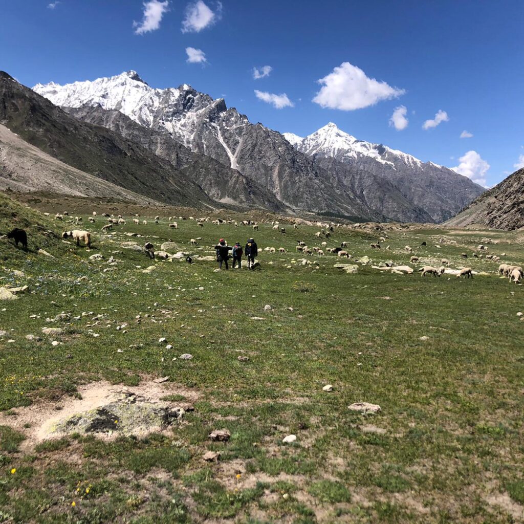

Miyar Valley Trek: Infinite Plains, Infinite Escapades
Before getting into the details, let me provide some context for those who are not familiar with this place. Those who know already can skip to the main part.
Miyar Valley in the Lahaul region of Himachal Pradesh is a secluded area sandwiched between the Pir Panjal and Zanskar ranges. The Miyar Nala is the lifeline of the valley and it meets the Chandrabhaga near Udaipur . The sparsely populated villages here give way to a high altitude, open plain, which eventually leads to a glacier and a pass. It takes a lot of time to reach and remains cut-off during the winters. It has not yet been commercialized much for tourism and is only frequented by serious trekkers, climbers, and lovers of desolation. People here are mostly Buddhists.
Here is a rough map to make you understand the location. As usual, it is not accurate or up to the scale.

Also Note: This post also describes a meeting with a Gaddi herder. Gaddis are semi-nomadic people who practice transhumance. They have been herding sheep and goats in these high-altitude Himalayan meadows since time immemorial. They are natural mountaineers and they merely stroll over the high passes, while the modern hikers huff and puff through the same.
______________________

Last year at I left Miyar with disappointment in heart and those unfulfilled dreams kept haunting me. This year I returned to make sure that I at least visit the famed, seemingly limitless plains fed by the Miyar Nala. Of course crossing over to Zanskar by completing the complete trail remains a dream and not sure if I will ever be able to do that. Nevertheless, even this quick foray had enough to see and recount. So, let me produce a blow-by-blow detail of the same.
4 pm Reached Shukto after a long bus ride from Keylong via Trilokinath and Udaipur. The elusive Homestay at Shukto had a more prominent board in place now. Last time I think the board wasn’t there and I did not even realize it was a Homestay.
I am not alone this time for a change. In fact, the group had far more people than I expected. Now we were seven people including the guy who was originally supposed to join me, his friends, and friends of those friends. But in a way, it was a good thing because we secured one large room with several beds and mattresses. It was worth INR 700 i.e. 100 per head (I am sure the rates will be lower for a lesser number of people).
5 pm Went out for some local sightseeing. My hope was to walk back to one of the previous villages such as Tingrit that we passed earlier. However, there were several hilly streams on the road. Earlier the bus crossed them for us. But crossing them by foot looked difficult and risked getting wet in that chilly evening. So, gave up on that plan and just walked around the river bank and the nearby hills, taking photographs of the lusty river, uniquely shaped conifers, pink wildflowers, and vast moraines.

9 pm The food was good. Rice was accompanied by local beans and potatoes. Some local liquor was also produced quickly. Ate as much as we could because the next day was going to be a long day with no other provisions en route.
7 am One left due to some urgencies and six of us remained for the actual trek. We planned to start as early as possible but it took some time before everyone got ready, ate some leftovers from the night, and bought some biscuits as the day’s ration.
7.30 am Reached Khanjar, the last village in the valley. It can be seen from Shukto itself but the road ends at Shukto. One has to cross a shaky hanging bridge and hike for 15 minutes to reach it. The village itself was pretty enough with fields of potatoes and peas but we were in for a very long day and so did not have much time to appreciate the rustic charms of the village.

8.30 am We continued to trek for a while, passing through the village and trying to figure out the trail. What we soon realized was that there are many streams crisscrossing the valley, all tributaries of Miyar or tributaries of even those tributaries. The trail was not a consistent upwards climb. It was repeatedly going down to some bridge over some stream and ascending again.

Eventually, we reached a somewhat plain grassy meadow with a slim stream running through it. It seemed like a good place for a siesta but much more remained to be covered for the day. So, we continued with the same routine.

9.30 am A chorten is visible at a distance. We were told that the first stop of the trek is called “Gompa/Gumba” although it was hard to believe that there will be a Gompa so far into the wilderness beyond the last village. So, is that the one?
10.00 am That chorten still looks as far as it looked initially. One local villager with a cow raced ahead of us!
10.30 am Finally reached that chorten. There is no other structure nearby and the mysterious Gompa remained a mystery. The villager with the cow lit a ceremonial fire near the chorten. He was not going beyond this point. So, we were on our own again.

11.00 am Crossed a few more streams. All of them seem to have at least one man-made wooden bridge but they are not easy to locate and at times you may end up walking through the water rather than looking for the bridge.
11.30 am Finally, we have reached a plain area. There are mountains in the horizon but those are far away and in front of us we can only see a vast, endless plain. A small caravan comprising of mules and horses has joined us. They are taking supply to some point ahead so we thought it to be logical to just follow them.

12.30 pm We have been walking for almost an hour now and there seems to be no end to these plains. The distant mountains look as distant as they looked an hour ago. Finally, the high altitude exertion at almost 4000 meters is also beginning to show its impact. It is becoming tiresome.
12.45 pm Finally, everyone stopped. I was lagging behind a bit. Not sure who realized it first but apparently we were already at “Gompa” although there was no Gompa in sight. Later on, we figured out that the place is called so because some Lamas of yore used to meditate nearby and there is no real shrine here. Anyway, what was visible here was a den of Gaddis but we needed to regain our composure before approaching them.
1.00 pm We are eating biscuits and drinking natural mineral water from the stream like there is no tomorrow. We soon ran out of supply. A joint was rolled to soothe the nerves. The wind in that barren expanse at that altitude was severe. It was the yearning of the cold mountains that have been lonely for millions of years. The wind made sure that we quickly ran out of the spliff too.
1.15 pm Nevertheless, we have calmed down a bit by this time and now we decided to approach the Gaddis. One guy tried but was chased away by one of the ferocious shepherd dogs. But after a while, we managed to get close to the only Gaddi who was manning the post at that time. He noticed us and made a friendly gesture by spreading his blanket over the ground and inviting us to have a seat.

1.45 pm The guy must have been really bored all this while, tending to his goats and roaming around the desolated mountains for months. So, he was eager to talk and we let him go on. He is here with his uncle and a hundred goats and doesn’t mind some extra company without the generation (or species) gap. We did not have to try too hard as he got going all by himself. He talked about all the passes he has crossed with his goats such as Chobia and Kalicho, the ones that even hardened trekkers hesitate to try. Trekkers and mountaineers have started traversing these terrains only in the last few decades. Till then, mostly the Gaddis used to discover these trails and had the balls to cross them.
2.00 pm He is still talking while I am shivering. The break has cooled down my system and the wind is piercing through my inadequate clothing. He is now talking about some dengue-stricken Dehlites who visited their den in Pathankot to buy goat milk. While one is tempted to imagine the Gaddis to be some esoteric hill tribe gleefully detached with the rest of the world, that is far from the truth. During the winter they return to their respective stations, which are generally located nearer to the plains. They have been doing this for generations but they also know what is going on around the world.
2.15 pm We finally wrapped up the conversation. We had to return, which means at least four hours more of this tedious hiking. I even forgot to ask his name and I deeply regret it. But none of us were in a position to do too much thinking. However, we recorded most of the conversation on camera. I am posting the first part. Someday I hope to edit the whole conversation in a professional manner, along with better sound and subtitles.
2.30 pm We had quickly passed through the most delightful part of the Valley earlier. Now, we decided to give it due attention. It is a bed of wildflowers, something that every other account of Miyar has effusively mentioned. Yellow and purple were the predominant hues at that point and although the weather was gloomy, we devoted enough time to take disappointing photographs. I think these were Iris and Yellow Potentilla but correct me if I am wrong. There are many stony patches in between, all covered with orange and green lichens. Another stretch was pink with Himalayan Knotweed or Himalayan Fleece. The light was deteriorating fast though. I only wish if I could photograph these delirious sights on a bright, sunny day!

3.00 pm We are walking fast and making rapid progress. A light drizzle has started. Saw a puddle where a lot of sheep are quenching their thirst. Nice sight, nice frame…. but… hey, we never saw it when we were coming. Have we taken a wrong turn somewhere?
3.15 pm Now we are certain that we have lost the way! It is hard to imagine in an open plain like this. We were following the herd of sheep but they didn’t have to return to the village. So, we paused to take stock of the situation.

3.30 pm We located a herd of cows with one Yak and a few Dzos mixed with them. They were crossing one stream so we figured that to be the right way. However, crossing the stream is not that easy and the bridge is nowhere in sight!
3.45 pm A stone in the middle of the stream, a hesitant step, a slip, and a fall! Thankfully the water was not very deep. But the clothes are all wet now and I am freezing. But the worse was yet to come!
4.15 pm That fall was just the beginning. Now I am stuck on the banks of a deeper and stronger stream. It is hard to explain how I ended up here. Others seemed to have found an easier way to the bridge. But in an effort to find a shortcut, I have got myself stuck on the steep bank with a possibility of falling into the water and drowning. Due to the earlier fall, I don’t feel like taking that one step that will get me out of here. Also, in case anyone is wondering, there are no more photographs. Too exhausted for such creative pursuits now.
4.30 pm Finally took that leap of faith and got out of the problem spot. The bridge can now be seen and the route ahead is now devoid of confusion although I have no strength left!
5.30 pm The return feels much longer due to all the tiredness, made worse by that unfortunate detour. But we must go on as there is no other option.
6.00 pm Finally nearing the village. Every bone is screaming in protest.
6.45 pm Crossed the village and the Miyar Nala one last time. Almost 30 Kilometres had been covered in one day! Decided to rest by the side of the river. Another one is being rolled. That is all for today. Even writing about it has been a tiresome exercise!
———————
Miyar Valley Trek DIY Guide
How to reach Miyar Valley? The easiest way to reach Miyar is to first reach Keylong by crossing Rohtang Pass from Kullu or Manali. Next morning get the 8 AM bus going to Khanjar, which is the last village in the valley. As a matter of fact, there is no road till Khanjar and the bus goes only till Shukto, just before Khanjar. You can stay here and then trek the next day.
Where to stay at Miyar Valley? The best option here is Tashi Homestay at Shukto. I have been told that one can also stay in other villages like Tingrit and Urgos but Shukto makes perfect sense as it is the last road-head and the bus stops right in front of it. Per head cost here should not be more than INR 300-400 for a day. And remember that this also includes food. It gets cheaper if you have more people in the team.

How long is the trek? The actual trek is a 5-6 day trek that takes you to the Zanskar region of Ladakh through the Miyar Valley and Kang La. However, one can also visit the valley and come back. Most people do it for 2-3 days while camping in the valley. We had to do it in one day because, as you know, I am always on budget and never have money to hire guides and supplies.
What is the average altitude of the valley? Even the last villages are around 3500 meters. The plain valley should be close to 4000 meters. In order to reach Zanskar, you will have to cross the far higher Kang La (more than 5400 meters). There are also many peaks in the valley that attracts climbers.
What is the right season for Miyar Valley Trek? As you might have guessed already, it mostly remains inaccessible in the winter and I doubt if the snow will clear even in May. So, you basically have a brief window between June and October.
Is it similar to Ladakh? Well, as I have mentioned earlier, the region borders Ladakh. So, it offers the best of both Himachal and Ladakh as you gradually proceed. Of course, that does not mean I am done with Ladakh. I still haven’t made a proper exploration of Ladakh and reading Ladakh travel guides nowadays, hoping to get there soon.
How long is the day trek?
After the initial climb, you get to walk on a flat plain, which is easier. However, it is also a very long stretch. Overall, our hike was around 13-14 KMs long one side. It is easy if you are camping. But we returned the same day, and also made a detour as we lost the way. So, we ended up covering around 30 KMs in one day.
Where do I find guides and supplies for long trek? I only did the first part and returned the same day. I did it without a guide but as you can see, you will need them for longer adventures. You can ask for local guides in the villages where you stay. Someone will surely turn up. But if you need supplies, it will be better if you buy them from Udaipur, the last town en route.
Phone and data connectivity in Miyar? Only BSNL connections work in the valley. Till Udaipur my Airtel worked (No data only calling).
Should I take my stock of Old Monk? You can get them from Keylong or maybe from Udaipur. However, you can always score some local liquor for a change. The good people at the Homestay should be able to help.
- Latest Posts

- Tiger’s Nest Trek, Paro Taktsang - 2024/03/21
- Your Ultimate Guide to Ensuring Great Experiences in Jaipur - 2024/03/20
- A Holiday Idea: A Sports Tour of France - 2024/03/20
Related Posts

Valley of Flowers: Into No Man’s Land

McLeod Ganj: Moksha through the Cardinal Sin

Sach Pass: Stairway to Elysium

Hamta: Countless shades of Green

Karsog: How Green Was Their Valley!

How not to trek to Indrahar Pass
38 thoughts on “miyar valley trek: infinite plains, infinite escapades”.

This looks like some trek, your post makes me want to try it. Camping in the valley seems like something right up my street 🙂

I don’t know why but I have always loved this type of experience! The fact that the actual trek is a 5-6 day makes all so interesting. Several days surrounded only by nature is a dream 🙂

It sounds like you had a real adventure in the Miyar Valley! I applaud you for doing this trek; it seems very tiresome. The Gaddis are interesting people, but were they friendly? Thanks for sharing this post on a place I’ve never heard of.

Woo, sounds like you had quite an adventure! Lovely photos as well

That is quite an adventurous trek you had there! I love the blow by blow detail of the trek as it feels like we were there with you on the journey and understand the struggles. But for all of the challenges you’ve met during the trek, I have to say that the views are worth it. From the snow capped mountains to the rivers and the meadows, I bet it was worth it!

That’s just such a beautiful place. So unexplored indeed.. I’ve heard of Spiti and Lahaul (which are famous) and haven’t heard of Miyar. Thanks for the map. Very useful indeed. You managed to head to Miyar twice? Whoa!

I love this authentic experience. Not only was the journey absolutely stunning and unforgettable, but having an intimate experience with someone with such a unique way of life would have been mesmerizing

Wow, such beautiful scenery and it looks like a completely unexplored wilderness! I love reading about conversations and meetings with local people, it really adds a back story and some authenticity. This was a lovely post and your pictures are wonderful!

Firstly what beautiful pictures, they took me back to when I trekked to Everest Base camp. I love hiking & I would love to go here and do this route especially as it is off the beaten track l. That scenery is just beautiful and I love the fact you got to met a local and u derstand thier way of life.

What a gorgeous landscape! I would love to take a trek like this some day! Miyar sounds like an wonderful place

Wow. What a journey. Your pictures tell a great story. I have yet to do this type of adventure and it would take me a lot of mental preparation before I did. I’ll do anything in the water but hilly / mountainous terrain Im hesitant.

What an incredibly stunning spot. I can see you would enjoy just savoring the view. We always travel with the kids and they are getting big enough to do more hiking! We carried them when they were small but then there has been a gap for the last few years as they have built up their stamina. Now at 11 and 13 we can start thinking about some hiking adventures like this one!

wow Just Wow. I totally love your pictures and they made me feel like am there . This truly sounds like an adventure which I would love to do . Thanks for sharing your experience

What a breathtaking view of the mountains from the plains. I can’t top that Miyar Valley trek of yours. Getting lost in the middle of nowhere but you were brave enough to forge ahead. Kudos to you!

Thanks for introducing me to the Miyar Valley. I have never traveled with a yak, but if I could, I’d want it to be as beautiful as this! Your photos are absolutely beautiful.

I haven’t heard about this place before. It looks like an awesome trek indeed. Your pictures make your post very understandable. Thanks for sharing!

Wow! What a beautiful part of the world! Your pictures are absolutely stunning! Thank you for introducing Miyar Valley to me.

From the sounds and looks of it, this looks like a pretty epic trek! The scenery looks amazing. I love going on long treks as you really get to immerse yourself in your surroundings.

Whoa 30km in one day! An intense hiking day. You’ve really captured the beautiful landscape in the photos. I bet you were looking forward to a good meal especially after running out of biscuits.

Thanks for sharing your incredible trek and amazing pictures too! We are planning to visit India next year and looking at different mountain treks so will definitely consider this one. I would love to chat with the Gaddis like you did!

That looks like some track! The photos make me really want to try it, it looks stunning. You also write beautifully, I was completely engrossed.

I had never heard of the Miyar Valley so thanks for sharing this post. This trek looks incredible. I love every single one of your awesome pictures. So beautiful. Not sure I could cope with a 5-6 days trek but with sceneries like this I’d be willing to try. It would be nice to meet the locals too. Well done!

Such a fascinating read man…I felt I was almost there with you. You have really tempted me to follow your footsteps to the gorgeous Miyar valley…
Loved the video of the conversation with the guy from Pathankot…loved his accent 🙂

So glad you had the opportunity to visit Miyar Nala this time – I hope you do have the chance to make our dream of crossing over to Zanskar by completing the complete trail a reality some day. You did get some absolutely stunning landscape photography from your time though, and how interesting to have had the opportunity to speak to a Gaddi. 30 km in a day is quite the trek – congrats – sorry to hear you took a fall though, I would have been so scared stuck on those banks! Sounds like quite the arduous hike, but a very beautiful one 🙂

Pictures of India like these are making me wanna go to India! Crazy how diverse the landscapes there. Are those snow caps up in the mountain?

What an amazing hike. The area is simply stunning, those plains and mountains. It would have been very cool to sit down and chat to the Gaddi herder, that really is an amazing experience. I can’t believe that you completed this all in one day!

As always, a very well written detailed post. I always get to discover something new and interesting on your blog. And this read was exactly like I was walking with you there. But Hats off to you!! You did 30 km in a day. Interesting conversation with the main. I loved this place as well as your post.
Pingback: Hudan Bhatori to Hudan Lake | The Travelling Slacker
Pingback: 10 Genuinely Unexplored Places in Himachal Pradesh | The Travelling Slacker
Pingback: Travelling Slacker: Yearly Travel, Traffic, & Turnover Review | The Travelling Slacker
Pingback: Keylong & Lahaul Travel Guide – The Travelling Slacker

Forever giving offbeat travel goals! You took me right there. Can you help with the home stay contacts please!

Yes I have the contact. Let me know when you need.

Which month did you do the trek

Amazing Pics and Trek! The way you did it is unbelievable. I dont think I will be able to any such treks again now that both me and Manish are incing closer to 50. But then, there is no dearth of other genres of travel and places.

Can you share the contact details of the homestay?
Pingback: 13 Best Offbeat Treks In India That You Must Know | A Detailed Guide
Leave a Comment Cancel Reply
Your email address will not be published. Required fields are marked *
Save my name, email, and website in this browser for the next time I comment.
This site uses Akismet to reduce spam. Learn how your comment data is processed .

The Yosemite of the Himalayas
Miyar valley trek, via changut , ₹12999 + 5% gst, june to september, via changut (3990m), ₹12999+ 5% gst, changut to changu t, + rs. 1800 backpack offloading + rs. 757 mandatory insurance + rs ₹6500 transport manali to changut (5-6 persons), difficulty level - 4, himachal pradesh - 6 days - 60 kms, up to 15% off in may-jun batches for a limited period ✨, july & september 2023, miyar valley.
The Miyar Valley is a picturesque valley located in the Indian state of Himachal Pradesh, specifically in the Lahaul and Spiti districts. It is known for its natural beauty, stunning landscapes, and remote wilderness.
Situated in the Himalayas, the Miyar Valley is surrounded by snow-capped peaks, lush green meadows, and gushin g rivers. It offers breathtaking views of glaciers, waterfalls, and alpine forests. The valley is home to a diverse range of flora and fauna, including several species of birds and wildlife.
The Miyar Valley is a popular destination for trekking enthusiasts and adventure seekers. It offers various trekking routes that cater to different skill levels, from beginners to experienced trekkers. One of the most famous treks in the region is the Miyar Glacier trek, which takes you through the valley and up to the majestic Miyar Glacier.
During the trek, you can experience the tranquility of the valley, interact with local villagers, and witness their unique culture and way of life. The villages in the Miyar Valley are known for their traditional wooden houses, Buddhist monasteries, and warm hospitality.
The best time to visit the Miyar Valley is during the summer months, from June to September when the weather is pleasant and the trekking trails are accessible. However, it's important to note that the weather in the Himalayas can be unpredictable, and it's advisable to check local conditions and be prepared for sudden changes.
Overall, the Miyar Valley offers a serene and off-the-beaten-path experience for nature lovers and adventure enthusiasts, showcasing the awe-inspiring beauty of the Himalayan region.
The Miyar Valley Trek is a popular trekking destination located in the Indian state of Himachal Pradesh. Nestled in the Pir Panjal Range of the Indian Himalayas, the Miyar Valley offers stunning natural beauty, remote landscapes, and a chance to experience the rich cultural heritage of the region.
The trek usually starts from Udaipur, a small town in the Lahaul district, which can be reached from Manali by road. From Udaipur, the trail follows the Miyar Nala (river) through picturesque villages, dense forests, and open meadows. The route takes you past ancient monasteries, and traditional villages, and offers breathtaking views of snow-capped peaks, including the towering Kang La Pass.
The duration of the Miyar Valley Trek varies depending on the itinerary chosen and the fitness level of the trekkers. Generally, it takes around 7 to 10 days to complete the entire trek, including acclimatization and rest days. The trail is considered moderately difficult, and prior trekking experience is recommended.
During the trek, you will be able to interact with the local people, mainly those from the Bhutia and Gaddi communities. You can learn about their unique customs, traditions, and their way of life in the mountains. The region is also known for its vibrant flora and fauna, including a variety of wildflowers, medicinal plants, and occasionally, sightings of Himalayan wildlife such as snow leopards, ibex, and musk deer.
It is essential to be well-prepared for the Miyar Valley Trek, as it involves walking on rough terrains, crossing streams, and ascending to high altitudes. Proper trekking gear, including sturdy shoes, warm clothing, a good sleeping bag, and a backpack, is necessary. It is also advisable to carry a first aid kit, water purification tablets, and high-energy snacks.
Given that conditions and regulations may change over time, it is recommended to consult us for the most up-to-date information and assistance in planning your Miyar Valley Trek.
Itinerary of Miyar Valley Trek
Day 1: Arrival in Manali (acclimatization)
On the first day of your Miyar Valley Trek, you will arrive in Manali, a popular tourist destination in Himachal Pradesh. Manali serves as the gateway to many trekking routes in the region. Here's what you can expect on this day:
Arrival in Manali: You will arrive at Manali, either by road or by air. If you're coming from a different city or country, you can reach Manali by taking a flight to Bhuntar Airport (Kullu) and then driving to Manali, which is approximately a 1.5 to 2-hour journey.
Acclimatization: Manali is located at an altitude of around 2,050 meters (6,726 feet), so it's important to spend this day acclimatizing to the high altitude. Take it easy and give your body time to adjust to the change in elevation. It's recommended to stay hydrated and avoid any strenuous activities.
Explore Manali: You can utilize this day to explore the town of Manali. Visit Mall Road, which is the main shopping area, and indulge in local cuisine and shopping. You can also visit the Hadimba Temple, Vashisht Hot Springs, and Old Manali for a cultural experience.
Gear Check and Preparation: Take this opportunity to double-check your trekking gear and ensure that you have all the necessary equipment. Make any last-minute purchases or rentals if required. This includes trekking shoes, a backpack, clothing layers, a sleeping bag, and other essentials.
Briefing and Orientation: If you have booked your trek with a trekking agency or a guide, they will likely conduct a briefing session to provide you with information about the trek, safety guidelines, and any other details you need to know. Pay attention to the instructions given during the briefing.
Rest and Relaxation: After a long journey, it's important to rest and allow your body to recover from any travel fatigue. Ensure you get a good night's sleep to prepare for the upcoming trek.
Overnight Stay: Spend the night in a hotel or guesthouse in Manali. There are various accommodation options available to suit different budgets.
Day 2: Manali to Udaipur
On the second day of your Miyar Valley Trek, you will leave Manali and make your way to Udaipur, the starting point of the trek. Here's what you can expect on this day:
Breakfast and Check-out: Enjoy a hearty breakfast at your hotel or guesthouse in Manali and check out from your accommodation. Ensure that you have all your belongings packed and ready for the trek.
Drive from Manali to Udaipur: Start your journey towards Udaipur, which is located approximately 162 kilometers (about 100 miles) from Manali. The drive takes approximately 5 to 6 hours, depending on road conditions and traffic. The route will take you through scenic landscapes, including lush green valleys, meandering rivers, and charming villages.
Lunch en route: During the drive, you can stop for lunch at a local restaurant or dhaba (roadside eatery) along the way. Indulge in some delicious local cuisine and fuel up for the trek ahead.
Arrival in Udaipur: Once you reach Udaipur, situated at an altitude of around 2,743 meters (8,999 feet), you will set up camp for the night. Udaipur is a small village known for its ancient temples and picturesque surroundings. Take some time to explore the village and soak in the peaceful ambiance.
Camp set-up: Upon reaching Udaipur, the trekking team or your guide will help you set up camp. Follow their instructions and assist in pitching tents, organizing camping equipment, and settling in for the night. Make sure to familiarize yourself with the campsite facilities, such as water sources and restroom facilities.
Evening at leisure: After setting up camp, you can relax and enjoy the serene atmosphere of Udaipur. Take a stroll around the village, interact with the locals, and immerse yourself in the local culture. Witness the mesmerizing sunset over the mountains, creating a beautiful backdrop for the start of your trek.
Dinner: In the evening, a hot and nourishing dinner will be served at the campsite. Enjoy a delicious meal prepared by the support staff or cook accompanying your trekking team.
8. Rest and acclimatization: Take this opportunity to rest and acclimatize to the higher altitude. It's crucial to allow your body to adjust gradually to the changing elevation to avoid altitude sickness.
Overnight Stay: Spend the night camping under the starry sky in Udaipur. The camping experience amidst the pristine surroundings will enhance your connection with nature.
Ensure you have essential items like warm clothing, a sleeping bag, a headlamp/flashlight, toiletries, and a water bottle readily accessible in your backpack. Follow the instructions of your trek leader or guide regarding safety precautions and any specific guidelines for the trek.
Day 3: Drive from Udaipur to Khanjer. Trek to Tharang
On the third day of your Miyar Valley Trek, you will embark on a scenic drive from Udaipur to Khanjar. From Khanjar, you will begin your trek to Tharang. Here's a detailed itinerary for this day:
Breakfast and Camp Packing: Start your day with a wholesome breakfast at the campsite in Udaipur. Pack up your camping gear and ensure that you have all the necessary items for the day's trek.
Drive from Udaipur to Khanjar: Begin your journey by boarding a vehicle that will take you from Udaipur to Khanjar. The drive will be approximately 10 kilometers (6.2 miles) and may take around 1 hour, depending on the road conditions. Enjoy the scenic views as you travel through the picturesque landscapes.
Arrive at Khanjar: Once you reach Khanjar, a small village located at an elevation of around 3,000 meters (9,842 feet), you will prepare to start your trek. Take some time to rest and acclimatize to the higher altitude.
Trek from Khanjar to Tharang: Start your trek from Khanjar, following a gradual ascent through enchanting landscapes. The trail will lead you through lush green meadows, charming villages, and forests, offering glimpses of the surrounding peaks and the Miyar River.
Lunch en route: During the trek, you will have a designated spot to stop and have your packed lunch. Enjoy a nourishing meal amidst the tranquility of nature and recharge your energy for the rest of the trek.
Continue to Tharang: Resume your trek after lunch, immersing yourself in the natural beauty of the Miyar Valley. Traverse through the diverse terrain, which may include rocky paths, river crossings, and gentle slopes. The journey from Khanjar to Tharang is approximately 6-8 kilometers (3.7-5 miles) and may take around 4-5 hours, depending on your pace and trail conditions.
Arrival at Tharang: Reach Tharang, a scenic camping site situated at an elevation of approximately 3,500 meters (11,483 feet). Tharang is known for its breathtaking views of the surrounding mountains and its peaceful ambiance. Set up camp for the night under the starry sky, surrounded by the majestic Himalayan landscape.
Dinner and Rest: In the evening, enjoy a warm and wholesome dinner prepared by the trekking team or cook. Engage in conversations with fellow trekkers, unwind, and relax. Ensure you get enough rest to rejuvenate for the upcoming days of the trek.
Overnight Stay: Spend the night camping at Tharang, surrounded by the pristine beauty of the mountains. The tranquility of the campsite will offer a memorable experience and a chance to connect with nature.
As you embark on the trek, it's essential to follow the guidance of your trek leader and adhere to safety protocols. Stay hydrated, maintain a steady pace, and take breaks as needed to enjoy the scenic views and capture memorable moments along the way.
Day 4: Trek from Tharang to Zardong
On the fourth day of your Miyar Valley Trek, you will continue your journey through the captivating landscapes of the Miyar Valley. You will trek from Tharang to Zardong, experiencing the beauty of the region and immersing yourself in the serenity of the surroundings. Here's what you can expect on this day:
Breakfast and Camp Packing: Begin your day with a nourishing breakfast at the campsite in Tharang. Pack your camping gear and ensure you have all the essential items needed for the day's trek.
Trek from Tharang to Zardong: Start your trek from Tharang, following the trail that winds through the picturesque Miyar Valley. The route will take you through a mix of terrains, including meadows, moraine fields, and river crossings.
Scenic Landscapes and Views: As you trek, take in the breathtaking views of the surrounding peaks, glaciers, and the gushing Miyar River. The beauty of the landscape, with its vibrant colors and towering mountains, will leave you in awe.
Lunch en route: During the trek, find a suitable spot to rest and enjoy a packed lunch. Take this opportunity to refuel and relax amidst the tranquil surroundings.
Continue to Zardong: After lunch, resume your trek towards Zardong. The trail will present various challenges and rewards, including steep ascents and descents, rocky paths, and possibly crossing streams. The distance from Tharang to Zardong is approximately 7-9 kilometers (4.3-5.6 miles) and may take around 5-6 hours, depending on the pace and trail conditions.
Arrival at Zardong: Reach the camping site of Zardong, situated at an elevation of around 4,000 meters (13,123 feet). Zardong offers panoramic views of the surrounding peaks and serves as a serene base camp for further exploration of the area. Set up camp for the night and enjoy the tranquility of the location.
Exploration and Relaxation: Once you arrive at Zardong, take some time to explore the vicinity, interact with fellow trekkers, or simply relax and enjoy the peaceful ambiance. You can soak in the beauty of the surroundings, capture stunning photographs, or engage in conversations around the campsite.
Dinner and Rest: In the evening, indulge in a warm and comforting dinner prepared by the trekking team or cook. Share stories and experiences with your fellow trekkers as you enjoy the meal. Rest well to rejuvenate for the upcoming days of the trek.
Overnight Stay: Spend the night camping at Zardong, surrounded by the enchanting beauty of the Himalayan landscape. The quietude of the campsite, coupled with the clear night sky, will create a memorable and peaceful experience.
Remember to maintain proper trekking etiquettes, such as leaving no trace, respecting the environment, and following the instructions of your trek leader. Stay hydrated, protect yourself from the sun, and be mindful of your surroundings as you continue your journey through the Miyar Valley.
Day 5: Trek from Zardong to Palpu
On the fifth day of your Miyar Valley Trek, you will continue your trekking adventure from Zardong to Palpu. This leg of the journey will take you through stunning landscapes and provide you with breathtaking views of the surrounding peaks. Here's what you can expect on this day:
Breakfast and Camp Packing: Begin your day with a nutritious breakfast at the campsite in Zardong. Pack up your camping gear and ensure you have all the necessary items for the day's trek.
Trek from Zardong to Palpu: Start your trek from Zardong, setting off on the trail that leads deeper into the mesmerizing Miyar Valley. As you trek, you will encounter diverse terrain, including meadows, rocky sections, and possibly some river crossings.
Scenic Views and Natural Beauty: Enjoy the captivating views of the snow-capped peaks, glacial streams, and the surrounding alpine landscapes. Take moments to appreciate the serenity of the environment and soak in the beauty of the area.
Lunch en route: During the trek, find a suitable spot to take a break and have your packed lunch. Take this opportunity to rest, refuel, and reenergize for the rest of the day's trek.
Continue to Palpu: After lunch, resume your trek towards Palpu, continuing to explore the wonders of the Miyar Valley. The trail may involve ascending and descending sections, challenging your endurance and providing you with a sense of accomplishment. The distance from Zardong to Palpu is approximately 8-10 kilometers (5-6.2 miles) and may take around 6-7 hours, depending on the pace and trail conditions.
Arrival at Palpu: Reach the Palpu camping site, situated at an elevation of around 4,200 meters (13,780 feet). Palpu offers awe-inspiring panoramic views of the surrounding peaks, including the mighty Kang La Peak . Take some time to settle in and set up camp for the night.
Relaxation and Exploration: Once you arrive at Palpu, enjoy the tranquility of the location and take in the natural beauty around you. You can explore the vicinity, interact with fellow trekkers, or simply relax amidst the serene surroundings. Capture the stunning vistas or engage in conversations with your trekking companions.
Dinner and Rest: In the evening, savor a warm and hearty dinner prepared by the trekking team or cook. Share stories and experiences with your fellow trekkers while enjoying the meal. Rest well to replenish your energy for the following days of the trek.
Overnight Stay: Spend the night camping at Palpu, surrounded by the pristine ambiance of the Himalayan mountains. The starry night sky and the peacefulness of the campsite will create a memorable experience.
As you continue your trek, remember to adhere to the principles of responsible trekking, respecting the environment and local culture. Stay hydrated, follow safety guidelines, and appreciate the natural wonders that unfold along the Miyar Valley Trek.
Day 6: Trek from Palpu to Miyar Glacier and back to Palpu
On the sixth day of your Miyar Valley Trek, you will embark on an exciting and challenging trek from Palpu to the magnificent Miyar Glacier. You will have the opportunity to witness the awe-inspiring beauty of the glacier before returning to Palpu. Here's a detailed itinerary for this day:
Breakfast and Camp Packing: Start your day with a wholesome breakfast at the campsite in Palpu. Pack your backpack with essential items such as water, snacks, extra layers of clothing, sunscreen, and a camera to capture the stunning sights.
Trek to Miyar Glacier: Begin your trek from Palpu, following the trail that leads you towards the famous Miyar Glacier. The route will take you through rugged terrain, rocky sections, and possibly some moraine fields.
Scenic Landscapes and Glacial Views: As you trek, immerse yourself in the breathtaking beauty of the surroundings. Enjoy panoramic views of the snow-capped peaks, glacial streams, and the vast expanse of the Miyar Glacier. Take time to appreciate the grandeur of nature and capture memorable photographs.
Lunch en route: Find a suitable spot along the trail to rest and enjoy a packed lunch. Take this opportunity to refuel and rejuvenate amidst the tranquility of the glacial landscape.
Explore Miyar Glacier: After lunch, continue your trek towards the Miyar Glacier. Upon reaching the glacier, take the time to explore its magnificent features, such as the sparkling ice formations, crevasses, and the immense scale of the glacier itself. Marvel at the raw power and beauty of nature in this awe-inspiring setting.
Return to Palpu: After spending sufficient time at t he Miyar Glacier, retrace your steps back to Palpu. Follow the same trail you took earlier, ensuring you stay attentive to the terrain and any changes in weather conditions.
Dinner and Relaxation: Upon returning to Palpu, indulge in a delicious dinner prepared by the trekking team or cook. Share stories and experiences with your fellow trekkers, relishing the sense of achievement from the day's trek. Take some time to relax and unwind, appreciating the tranquility of the campsite.
Overnight Stay: Spend another night camping at Palpu, surrounded by the serene beauty of the Himalayan wilderness. Rest well and enjoy the peacefulness of the campsite as you prepare for the upcoming days of the trek.
Remember to respect the fragile ecosystem of the glacier and follow the principles of Leave No Trace. It's crucial to adhere to safety guidelines, stay hydrated, and be mindful of any signs of altitude sickness or fatigue. The trek to Miyar Glacier is physically demanding, so pace yourself accordingly and seek assistance from your trek leader or guide whenever needed.
Witnessing the magnificent Miyar Glacier up close is a truly awe-inspiring experience that will leave a lasting impression. Embrace the beauty of the surroundings and create memories that will stay with you long after the trek concludes.
Day 7: Trek from Palpu to Gompa
On the seventh day of your Miyar Valley Trek, you will continue your journey through the stunning landscapes of the Miyar Valley. You will trek from Palpu to Gompa, immersing yourself in the cultural and spiritual richness of the region. Here's a detailed itinerary for this day:
Breakfast and Camp Packing: Start your day with a nourishing breakfast at the campsite in Palpu. Pack your camping gear and ensure you have all the necessary items for the day's trek.
Trek from Palpu to Gompa: Begin your trek from Palpu, bidding farewell to the picturesque campsite. The trail will take you through enchanting landscapes, including meadows, streams, and possibly some rocky sections.
Scenic Views and Cultural Encounters: As you trek, take in the breathtaking views of the surrounding mountains and immerse yourself in the cultural richness of the region. The Miyar Valley is known for its ancient monasteries, and you may encounter some along the way. Take the opportunity to explore and learn about the local customs and traditions.
Lunch en route: During the trek, find a suitable spot to rest and enjoy a packed lunch. Take this opportunity to refuel and relax amidst the tranquility of the surroundings.
Continue to Gompa: After lunch, resume your trek towards Gompa, keeping a steady pace and enjoying the natural beauty that unfolds along the trail. The distance from Palpu to Gompa is approximately 8-10 kilometers (5-6.2 miles) and may take around 5-6 hours, depending on the pace and trail conditions.
Arrival at Gompa: Reach the village of Gompa, situated at an elevation of around 4,000 meters (13,123 feet). Gompa is renowned for its ancient Buddhist monastery, which holds deep spiritual significance for the local communities. Take some time to explore the monastery, observe the religious rituals, and appreciate the serenity of the surroundings.
Cultural Interactions: Engage with the local monks or residents of Gompa, learning about their way of life, traditions, and the importance of the monastery in the community. Immerse yourself in the peaceful ambiance and experience the spiritual energy that permeates the area.
Dinner and Rest: In the evening, enjoy a warm and satisfying dinner prepared by the trekking team or cook. Share stories and experiences with your fellow trekkers, reflecting on the day's journey. Rest well to recharge for the upcoming days of the trek.
Overnight Stay: Spend the night in Gompa, either in a guesthouse or by camping nearby. Embrace the tranquility of the village and the spiritual atmosphere, allowing yourself to truly connect with the surroundings.
As you explore Gompa, remember to respect the local customs and traditions. Observe any guidelines or restrictions that may be in place at the monastery, such as dress codes or photography restrictions. Immerse yourself in the unique cultural experience that Gompa offers and appreciate the spiritual significance of the place.
The seventh day of your trek provides a beautiful blend of nature and culture, allowing you to witness the stunning landscapes of the Miyar Valley while delving into the spiritual heritage of the region.
Day 8: Trek from Gompa to Khanjer. Drive to Manali
On the eighth day of your Miyar Valley Trek, you will complete the final leg of your trekking adventure. You will trek from Gompa to Khanjer and then drive back to Manali, marking the end of your journey through the captivating Miyar Valley. Here's a detailed itinerary for this day:
Breakfast and Camp Packing: Begin your day with a satisfying breakfast at the guesthouse or campsite in Gompa. Pack your belongings and ensure you have everything you need for the day's trek and the subsequent drive.
Trek from Gompa to Khanjer: Start your trek from Gompa, bidding farewell to the serene village and its ancient monastery. Follow the trail that leads you through the picturesque landscapes of the Miyar Valley. The route may involve gentle ascents and descents, offering panoramic views of the surrounding mountains and valleys.
Scenic Views and Reflections: As you trek, take in the final views of the majestic peaks and the untouched beauty of the valley. Reflect on the incredible journey you've experienced over the past several days, cherishing the memories created along the way.
Lunch en route: Find a suitable spot along the trail to rest and enjoy a packed lunch. Take this opportunity to refuel and relax, savoring the last moments amidst the natural splendor of the Miyar Valley.
Continue to Khanjer: After lunch, resume your trek towards Khanjer, the endpoint of your trekking adventure. Follow the trail that leads you out of the valley, leaving behind the enchanting landscapes and cultural treasures of the region. The distance from Gompa to Khanjer is approximately 10-12 kilometers (6.2-7.5 miles) and may take around 5-6 hours, depending on the pace and trail conditions.
Arrival at Khanjer: Reach Khanjer, where vehicles will be waiting to transport you back to Manali. Take a moment to bid farewell to the trekking team and express gratitude for their support and guidance throughout the journey.
Drive to Manali: Embark on a scenic drive from Khanjer to Manali, relishing the changing landscapes as you descend from the mountains. The drive will take you through picturesque valleys, charming villages, and winding mountain roads. Enjoy the views and reflect on the incredible adventure you've just completed.
Arrival in Manali: Arrive in Manali, where you can check into your accommodation and take a well-deserved rest. Reflect on the remarkable experiences, breathtaking landscapes, and personal growth you've gained from the Miyar Valley Trek.
Celebration and Farewell: In the evening, celebrate the successful completion of your trek with your fellow trekkers, sharing stories and memories. Enjoy a delicious meal and raise a toast to the unforgettable journey you've undertaken together.
Congratulations on completing the Miyar Valley Trek! Take some time to relax and explore Manali, allowing yourself to soak in the vibrant culture and natural beauty of the region before continuing your onward journey.
Please note that the duration of the trek, distance covered, and timing mentioned in the itinerary are approximate and can vary based on various factors such as weather conditions, trail conditions, and the pace of the trekking group. It's essential to remain flexible and adaptable throughout the trek.
What is included in package?
Veg Food (Day 2 till Day 8). Three Meals a day.
Forest Permits/Camping Charges/Permits, Trek Permit Fee/IMF Permission (up to the amount charged for Indian nationals).
Camping tents, Temp rated sleeping bags, mattress
Safety Equipment includes static rescue rope, seat harness, carabiners, pulleys
Mountaineering course certified Trek Leader with Wilderness Emergency Responder & Rescue.
First Aid Certified Local guide, cook, helpers
Porters or mules for carrying common luggage
Last day transportation from Barshaini to Kasol
What is not included in package?
Meals during road journeys
Offloading of personal bags
Any kind of Insurance
Any expense of personal nature
Any expense not specified in the inclusion list
What is the Miyar Valley Trek?
The Miyar Valley Trek is a popular trekking route located in the Indian state of Himachal Pradesh, specifically in the Lahaul region. It offers a captivating journey through the pristine and remote Miyar Valley, surrounded by majestic Himalayan peaks and picturesque landscapes.
The trek typically starts from Udaipur, a small town in the Lahaul district, and follows the Miyar River upstream. The trail passes through charming villages, verdant meadows, dense forests, and glacier moraines, offering breathtaking views of snow-capped peaks, including Kang La (5,240 meters) and Kulti (6,109 meters).
The Miyar Valley Trek is known for its raw natural beauty, tranquility, and the opportunity to witness the local culture of the region. Trekkers can interact with the indigenous people of the valley, primarily the Gaddi shepherds, who migrate with their flocks of sheep and goats during the summer months.
The duration of the trek can vary depending on the chosen itinerary, but it typically takes around 8-10 days to complete. The difficulty level of the trek is considered moderate to challenging, as it involves long walking hours, steep ascents and descents, and some technical sections near the high passes.
Overall, the Miyar Valley Trek is a rewarding experience for nature lovers and adventure enthusiasts, providing a unique opportunity to explore the untouched beauty of the Himalayas and immerse oneself in the serenity of the remote valley.
How long does it take to complete the Miyar Valley Trek?
The duration of the Miyar Valley Trek can vary depending on the specific itinerary and the pace of the trekkers. On average, it takes around 8-10 days to complete the trek. However, the duration can be adjusted according to the preferences and fitness level of the trekkers.
The trek typically starts from Udaipur, a small town in the Lahaul district of Himachal Pradesh. From there, the trail follows the Miyar River upstream, passing through villages, meadows, forests, and glacier moraines. The trek involves ascending and descending several high passes, including Kang La (5,240 meters) and Kulti (6,109 meters).
It's important to note that the duration mentioned above is a general estimate and can vary depending on factors such as weather conditions, trekking pace, acclimatization needs, and any additional side trips or rest days incorporated into the itinerary.
It is advisable to plan the trek with a reliable trekking agency or experienced guide who can help in designing an appropriate itinerary based on your preferences and requirements.
What is the difficulty level of the Miyar Valley Trek?
The Miyar Valley Trek is considered to have a moderate to challenging difficulty level. It involves various factors that contribute to the overall challenge of the trek:
1. Altitude: The trek reaches high altitudes, with the highest point being Kulti Pass at 6,109 meters. Trekking at high altitudes requires proper acclimatization and can be physically demanding.
2. Terrain: The trail consists of a mix of terrains, including steep ascents and descents, rocky sections, moraines, and river crossings. Some parts of the trek involve negotiating uneven and challenging terrain.
3. Duration and Distance: The trek generally spans over 8-10 days, covering a considerable distance. Long walking hours and consecutive days of trekking can be physically demanding.
4. Weather Conditions: Weather conditions in the region can be unpredictable, especially during the monsoon and winter seasons. Trekkers may encounter rain, snow, or harsh weather, which adds to the challenge.
5. Remote Location: The Miyar Valley is a remote and less-traveled region, which means facilities and infrastructure along the trail are limited. This remoteness can pose additional challenges in terms of logistics and support.
While prior trekking experience is not mandatory, it is advisable to have a good level of fitness, stamina, and some experience of trekking at high altitudes. Regular physical preparation, including cardiovascular exercises, strength training, and endurance-building activities, can help in tackling the challenges of the trek.
It is recommended to trek with an experienced guide or join a reputable trekking agency that can provide support, guidance, and ensure safety during the Miyar Valley Trek.
What are the highlights of the Miyar Valley Trek?
The Miyar Valley Trek offers a range of highlights that make it a captivating and memorable trekking experience. Here are some of the key highlights of the trek:
1. Pristine Natural Beauty: The Miyar Valley is known for its unspoiled natural beauty. Trekking through the valley allows you to immerse yourself in breathtaking landscapes, including lush meadows, dense forests, glacial moraines, and stunning views of snow-capped Himalayan peaks.
2. Remote and Off-the-Beaten-Path: The Miyar Valley is relatively untouched and less-traveled compared to other popular trekking regions. This adds to the charm of the trek as you get to explore a remote and pristine part of the Himalayas, away from the crowds.
3. Cultural Encounters: Along the trek, you have the opportunity to interact with the local people of the region, primarily the Gaddi shepherds. These indigenous people migrate with their flocks of sheep and goats during the summer months, and their way of life provides insights into the local culture and traditions.
4. High Mountain Passes: The trek includes crossing high mountain passes, such as Kang La (5,240 meters) and Kulti (6,109 meters). These passes offer panoramic views of the surrounding peaks and valleys, providing a sense of achievement and adventure.
5. Glacial Lakes: During the trek, you may come across beautiful glacial lakes nestled amidst the mountains. These serene lakes, such as the Taintiri Lake, add to the scenic beauty and offer opportunities for photography and relaxation.
6. Wildlife and Flora: The Miyar Valley is home to diverse wildlife and flora. You may encounter Himalayan birds, including the Himalayan Monal, snow leopards, ibex, and other wildlife species. The region also boasts a variety of alpine flowers and plants, enhancing the natural beauty of the trek.
7. Solitude and Serenity: One of the main attractions of the Miyar Valley Trek is the sense of solitude and serenity it offers. With fewer trekkers compared to more popular routes, you can experience a peaceful and tranquil environment, allowing you to connect with nature and find inner peace.
These highlights combined make the Miyar Valley Trek a remarkable adventure, offering a unique blend of natural beauty, cultural experiences, and a sense of exploration in the remote Himalayan region.
Is it necessary to have prior trekking experience for the Miyar Valley Trek?
While prior trekking experience is not mandatory for the Miyar Valley Trek, having some level of trekking experience is highly recommended. The trek is considered to have a moderate to challenging difficulty level, and being prepared both physically and mentally will enhance your overall experience and safety on the trail.
Here are a few reasons why prior trekking experience is beneficial:
1. Physical Fitness: Trekking in the Himalayas requires a certain level of physical fitness and stamina. Prior trekking experience helps you understand the demands of long hours of walking, ascending and descending steep terrains, and dealing with varying weather conditions.
2. Altitude Acclimatization: The Miyar Valley Trek reaches high altitudes, and altitude sickness can be a concern. Having prior experience with high-altitude trekking allows you to better understand and manage the effects of altitude on your body. You will be familiar with acclimatization techniques, recognize the symptoms of altitude sickness, and take necessary precautions.
3. Technical Sections: The trek involves crossing high mountain passes, such as Kang La and Kulti, which may require basic technical skills and equipment like using trekking poles, negotiating rocky sections, and being comfortable with uneven terrain. Prior experience will give you confidence and familiarity with such situations.
4. Self-Reliance and Preparedness: Trekking in remote areas demands self-reliance and preparedness. Prior experience helps you develop essential skills like navigation, packing appropriate gear, managing food and water, and dealing with emergencies. It also helps you understand the mental challenges of long-duration treks.
If you do not have prior trekking experience, it is advisable to start with shorter and less challenging treks to build your fitness, confidence, and familiarity with trekking in the mountains. Joining a guided trek with experienced trekking professionals like Team Walking The Himalayas is highly recommended, as they can provide guidance, and support, and ensure your safety throughout the Miyar Valley Trek.
What is the best time to go on the Miyar Valley Trek?
The best time to go on the Miyar Valley Trek is during the summer months, from mid-June to September. This period is considered the trekking season in the region when the weather is relatively stable, and the trails are accessible. However, it's important to note that weather conditions can vary, and it's advisable to check the local weather forecast before planning your trek.
Here are some reasons why the summer months are ideal for the Miyar Valley Trek:
1. Pleasant Weather: During summer, the weather in the Miyar Valley is generally mild and pleasant, with daytime temperatures ranging from 15 to 25 degrees Celsius (59 to 77 degrees Fahrenheit). The nights can be chilly, especially at higher altitudes, so it's essential to carry appropriate warm clothing.
2. Accessible Trails: The summer months ensure that most of the trails are free from snow, making them accessible for trekking. This allows you to navigate the route more easily without encountering major obstacles due to snow or ice.
3. Lush Greenery and Blooming Flowers: Summer brings life to the landscape of the Miyar Valley. The meadows and forests are vibrant with lush greenery, and alpine flowers bloom in various colors, creating a picturesque and enchanting atmosphere.
4. River Crossings: The water levels in the rivers and streams are relatively lower during the summer months, making the river crossings along the trek safer and more manageable.
It's important to note that the monsoon season in the region usually begins in July and lasts until September. During this time, rainfall can be expected, which may impact the trail conditions and increase the risk of landslides. It's advisable to plan the trek in the earlier part of the summer season, in June or early July, to minimize the chances of encountering heavy rainfall.
Always stay informed about weather forecasts and trail conditions before embarking on the Miyar Valley Trek, and consider consulting with local trekking agencies or experienced guides for the most up-to-date information.
Are there any permits required for the Miyar Valley Trek?
Yes, permits are required for the Miyar Valley Trek. As the trek is located in the Indian state of Himachal Pradesh, trekkers need to obtain certain permits and permissions before undertaking the trek. Here are the key permits that you need:
1. Inner Line Permit (ILP): The Inner Line Permit is required for non-Indian nationals to visit certain areas of Himachal Pradesh, including Lahaul and Spiti districts. You can obtain the ILP online through the official website of the Himachal Pradesh government or apply for it at designated government offices.
2. Restricted Area Permit (RAP): The Miyar Valley falls within the restricted area, and therefore, a Restricted Area Permit is necessary for both Indian and foreign nationals to access the region. The RAP can be obtained from the District Magistrate's office in Keylong, Lahaul, or at the Sub-Divisional Magistrate's office in Udaipur.
It's important to note that permit requirements may change, and it is advisable to check the latest regulations and guidelines from the Himachal Pradesh government or consult with local trekking agencies or authorities to ensure compliance with the necessary permits.
Additionally, it's recommended to carry valid identification documents, such as passports or government-issued IDs, while trekking in the region, as they may be required for verification purposes by authorities along the trek.
Obtaining the necessary permits ensures that you are trekking legally and allows authorities to keep track of visitors for safety and conservation purposes.
What is the average cost of the Miyar Valley Trek?
The average cost of the Miyar Valley Trek can vary depending on several factors, including the duration of the trek, the services included, the level of comfort desired, and individual preferences. While I don't have access to real-time data, I can provide you with a rough estimate of the average cost range based on historical information:
1. Guided Trek: If you opt for a guided trek with a reputable trekking agency, the cost typically includes services such as a guide, porter, accommodation (camping or guesthouses), meals, permits, and transportation from the nearest major town to the trek starting point. On average, the cost for a guided trek in the Miyar Valley can range from approximately $700 to $1,500 USD per person for an 8-10 day trek.
2. Independent Trek: If you choose to trek independently, the cost can be lower as you won't be paying for guide and porter services. However, you'll still need to consider expenses such as permits, transportation, food, accommodation (camping or guesthouses), and equipment rental if necessary. On average, the cost for an independent trek in the Miyar Valley can range from approximately $400 to $800 USD per person for an 8-10 day trek.
3. Additional Expenses: It's important to budget for additional expenses, including transportation to and from the nearest major town or airport, accommodation before and after the trek, meals during travel, equipment purchase or rental (if needed), travel insurance, and personal expenses.
Please keep in mind that these cost estimates are approximate and can vary depending on factors such as the trekking season, exchange rates, group size, and individual preferences. It's always recommended to conduct thorough research, compare prices from different sources, and consider the services and facilities included in the cost to make an informed decision and plan your budget accordingly.
Are there any accommodation options available along the Miyar Valley Trek?
The Miyar Valley Trek offers limited accommodation options along the trail. As the region is relatively remote and less developed in terms of tourism infrastructure, trekkers often rely on camping as the primary accommodation during the trek. Here are the accommodation options available:
1. Camping: Camping is the most common and preferred accommodation option during the Miyar Valley Trek. Trekkers typically carry their own camping equipment, including tents, sleeping bags, and sleeping mats. There are several suitable camping sites along the trail, including meadows, near streams, or close to villages.
2. Homestays: In some villages along the trek, such as Khanjar and Tingret, you may find basic homestay options. These homestays provide a chance to experience the local culture and hospitality. However, it's important to note that the availability of homestays can vary, and it's advisable to inquire in advance or through a local trekking agency.
3. Guesthouses/Lodges: There are limited guesthouse or lodge options available in certain villages along the trek, such as Udaipur and Keylong. These guesthouses offer basic facilities, including a bed, simple meals, and shared bathrooms. However, it's important to note that the availability and quality of these guesthouses may vary, and it's advisable to inquire in advance.
It's important to keep in mind that the Miyar Valley Trek is known for its remote and off-the-beaten-path nature, and trekkers should be prepared for basic amenities and limited accommodation options. Camping is generally the most reliable and preferred choice for trekkers, providing flexibility and the opportunity to immerse oneself in the natural surroundings.
If you are trekking with a guided group, the trekking agency will typically arrange the necessary camping equipment and select suitable camping sites along the trail. However, if you are trekking independently, it is important to carry your own camping equipment or make arrangements to rent them in advance.
Are there any water sources along the Miyar Valley Trek?
Yes, there are water sources along the Miyar Valley Trek, which provide trekkers with access to drinking water. Here are some important points to know about water sources during the trek:
1. Rivers and Streams: The Miyar Valley is crisscrossed by several rivers and streams that flow through the region. These water bodies can serve as a source of water for drinking, cooking, and refilling water bottles. However, it's important to treat the water before consumption by using water purification tablets, filters, or boiling it to ensure it is safe for drinking.
2. Glacial Meltwater: The Miyar Valley is fed by glaciers, and the melting ice gives rise to glacial meltwater streams. These streams can be another source of water along the trek. It's important to exercise caution while collecting water from glacial meltwater streams, as the water might be extremely cold and fast-flowing.
3. Springs: There are natural springs scattered throughout the Miyar Valley, and they can provide clean and potable water. Springs are generally considered a reliable water source, but it's still recommended to purify the water as a precautionary measure.
4. Villages and Settlements: Along the trek, you may come across small villages or settlements such as Khanjar, Tingret, or Udaipur. These villages often have access to freshwater sources, such as community wells or taps. Trekkers may be able to refill their water bottles in these villages, but it's important to ask permission and respect the local customs and practices.
It's essential to plan your water requirements carefully during the Miyar Valley Trek. Make sure to carry enough water carrying capacity or hydration systems to sustain you between water sources. It's advisable to carry a water purification method to treat water from natural sources to prevent waterborne illnesses.
Additionally, it's recommended to consult with local trekking agencies, experienced guides, or fellow trekkers for up-to-date information on water sources and their reliability along the specific route you plan to take during the Miyar Valley Trek.
What is the highest altitude reached during the Miyar Valley Trek?
The highest altitude reached during the Miyar Valley Trek is at the Kang La Pass, which stands at an approximate elevation of 5,240 meters or 17,192 feet. Kang La Pass is one of the prominent highlights of the trek and offers stunning panoramic views of the surrounding Himalayan peaks and the beautiful landscape of the region.
Reaching such high altitudes requires proper acclimatization and physical fitness. It's important to be prepared for the challenges of high-altitude trekking, including the thinner air, lower oxygen levels, and potential altitude-related symptoms. Adequate rest, proper hydration, and gradual ascent are crucial to minimize the risks associated with high altitude.
It's recommended to consult with experienced guides or trekking agencies who can provide guidance on acclimatization strategies and ensure your safety during the trek.
Is it possible to do the Miyar Valley Trek independently, or is a guide recommended?
The Miyar Valley Trek in India can be done independently, although hiring a guide is recommended for several reasons:
1. Navigation and Safety: The Miyar Valley Trek involves traversing remote and rugged terrain. A guide with local knowledge and experience can help navigate the trail, identify safe paths, and ensure your safety throughout the trek.
2. Cultural Insight: A guide can provide valuable insights into the local culture, traditions, and history of the region. They can enhance your understanding of the area and facilitate interactions with the local communities you encounter along the way.
3. Language Barrier: If you're not familiar with the local language (which is often the case for international travelers), a guide can help bridge the language barrier and facilitate communication with locals, making your experience more immersive and enjoyable.
4. Logistics and Planning: Hiring a guide can take care of logistical aspects such as arranging permits, organizing accommodation, and managing transportation. They can also assist with equipment rental or purchase if needed.
5. Emergency Situations: In case of any unforeseen circumstances or emergencies during the trek, a guide can provide assistance, first aid, and contact emergency services if required. They are trained to handle such situations and ensure your well-being.
That being said, experienced and self-sufficient trekkers with excellent navigational skills can choose to undertake the Miyar Valley Trek independently. However, it's important to thoroughly research the trail, prepare adequately, carry necessary equipment, have a detailed map or GPS, and inform someone about your plans and expected return.
Ultimately, the decision to hire a guide or trek independently depends on your level of experience, comfort, and familiarity with the area. Assess your abilities and preferences before making a decision, and consider your safety and the overall quality of your trekking experience.
Are there any risks or dangers involved in the Miyar Valley Trek?
Like any remote trekking adventure, the Miyar Valley Trek in India has its share of risks and challenges. It's important to be aware of these potential dangers and take necessary precautions. Here are some risks and dangers associated with the Miyar Valley Trek:
1. Altitude and Acclimatization: The trek involves gaining altitude, and altitude sickness can be a concern. It's essential to acclimatize properly by ascending gradually, staying hydrated, and recognizing the symptoms of altitude sickness. Be prepared to take rest days if needed.
2. Weather Conditions: Weather in the Himalayan region can be unpredictable and harsh, especially during the winter and monsoon seasons. Snow, rain, strong winds, and extreme temperatures can pose risks. Check weather forecasts and plan your trek accordingly. Be prepared with appropriate clothing and gear.
3. Remote and Challenging Terrain: The Miyar Valley Trek takes you through rugged and remote terrain. The trail can be steep, rocky, and demanding at times. Be cautious while navigating tricky sections and ensure you have proper trekking footwear and equipment.
4. River Crossings: The trek may involve river crossings, especially during the early summer when snow melts and water levels rise. Pay attention to safety protocols for river crossings, such as using ropes, choosing the right spots, and assessing the water flow.
5. Wildlife: The region is home to various wildlife species, including bears and snow leopards. Although encounters are rare, it's important to be cautious and follow safety guidelines for wildlife encounters. Store food securely and make noise to alert animals of your presence.
6. Lack of Facilities: The trek takes you through remote areas with limited or no facilities such as accommodations, food, or medical aid. It's crucial to carry sufficient supplies, including food, water, first aid kit, and camping gear. Additionally, be prepared for the possibility of no cell phone reception.
7. Remote Rescue and Emergency Services: In case of emergencies or injuries, access to medical facilities and rescue services can be challenging due to the remote nature of the trek. Having a satellite phone, emergency communication devices, and knowledge of basic first aid is advisable.
To mitigate these risks, it is recommended to trek with a guide or an experienced group, have proper trekking equipment, carry a detailed map or GPS, research the trail thoroughly, and inform someone about your plans and expected return dates. Prioritize safety, be prepared, and make responsible decisions during the trek.
Are there any alternate routes or variations of the Miyar Valley Trek?
Yes, there are alternate routes and variations of the Miyar Valley Trek that you can consider based on your preferences, time availability, and trekking experience. Here are a few options:
1. Miyar Glacier Trek: This variation takes you further up the Miyar Valley to the stunning Miyar Glacier. It offers an opportunity to witness the glacier's beauty and explore the surrounding high-altitude landscapes. This extension adds a few more days to the trek, requiring proper acclimatization and mountaineering skills.
2. Kang La Pass Trek: The Kang La Pass is a challenging high-altitude pass located near the Miyar Valley. This route involves crossing the pass and connects the Miyar Valley with the Zanskar region in Ladakh. It requires experience in high-altitude trekking, navigation, and camping skills.
3. Chhota Bhangal and Bara Bhangal Trek: This variation combines the Miyar Valley Trek with the Chhota Bhangal and Bara Bhangal region in Himachal Pradesh. It offers a longer and more adventurous trekking experience, taking you through diverse landscapes, remote villages, and challenging mountain passes.
4. Circular Trek: Instead of retracing your steps, you can consider a circular trek by combining different trails in the region. This allows you to explore additional valleys, passes, and villages while avoiding backtracking on the same route.
It's important to note that some of these alternate routes or variations may require additional permits, mountaineering skills, and logistical arrangements. They are typically more challenging and suitable for experienced trekkers. Before attempting any variation, thoroughly research the route, consult with local guides or trekking agencies, and assess your fitness level and experience.
Always prioritize safety, carry necessary equipment, and ensure proper acclimatization. Obtaining accurate information and seeking guidance from experienced trekkers of Walking The Himalaya or local authorities can help you plan and execute these alternate routes successfully.
Russia Travel Blog | All about Russia in English
- About our blog
- RussiaTrek.org
Sidebar →
- Architecture
- Entertainment
- RussiaTrek.org News

- Send us a tip with a message
- Support RussiaTrek.org
- Travel Guide to Ukraine
- Comments RSS
← Sidebar
The trains and stations of the Moscow Metro
2 Comments · Posted by Alex Smirnov in Cities , Travel , Video
The Moscow Metro is the third most intensive subway system in the world after Tokyo and Seoul subways. The first line was opened on May 15, 1935. Since 1955, the metro has the name of V.I. Lenin.
The system consists of 12 lines with a total length of 305.7 km. Forty four stations are recognized cultural heritage. The largest passenger traffic is in rush hours from 8:00 to 9:00 and from 18:00 to 19:00.
Cellular communication is available on most of the stations of the Moscow Metro. In March 2012, a free Wi-Fi appeared in the Circle Line train. The Moscow Metro is open to passengers from 5:20 to 01:00. The average interval between trains is 2.5 minutes.
The fare is paid by using contactless tickets and contactless smart cards, the passes to the stations are controlled by automatic turnstiles. Ticket offices and ticket vending machines can be found in station vestibules.

Tags: Moscow city
You might also like:

The bridge over Zolotoy Rog Bay in Vladivostok
The views of St. Petersburg from the TV tower >>
Tomás · August 27, 2012 at 11:34 pm
The Moscow metro stations are the best That I know, cars do not.
Alberto Calvo · September 25, 2016 at 8:57 pm
Great videos! Moscow Metro is just spectacular. I actually visited Moscow myself quite recently and wrote a post about my top 7 stations, please check it out and let me know what you think! :)
http://www.arwtravels.com/blog/moscow-metro-top-7-stations-you-cant-miss
Leave a Reply
XHTML: You can use these tags: <a href="" title=""> <abbr title=""> <acronym title=""> <b> <blockquote cite=""> <cite> <code> <del datetime=""> <em> <i> <q cite=""> <s> <strike> <strong>
- February 2024
- January 2024
- December 2023
- November 2023
- October 2023
- September 2023
- August 2023

Moscow Metro Font

Moscow Metro is a multi-line display typeface inspired by the Moscow underground map. It comes in Regular and Color versions.
Moscow Metro is ideal for posters and headlines, neon signage and other artworks.
- Share by email
Designed by: Nadira Filatova Website
License: free for commercial use.

- Bahasa Indonesia
- Slovenščina
- Science & Tech
- Russian Kitchen
Why were so many metro stations in Moscow renamed?

Okhotny Ryad station in Soviet times and today.
The Moscow metro system has 275 stations, and 28 of them have been renamed at some point or other—and several times in some cases. Most of these are the oldest stations, which opened in 1935.
The politics of place names
The first station to change its name was Ulitsa Kominterna (Comintern Street). The Comintern was an international communist organization that ceased to exist in 1943, and after the war Moscow authorities decided to call the street named after it something else. In 1946, the station was renamed Kalininskaya. Then for several days in 1990, the station was called Vozdvizhenka, before eventually settling on Aleksandrovsky Sad, which is what it is called today.

The banner on the entraince reads: "Kalininskaya station." Now it's Alexandrovsky Sad.
Until 1957, Kropotkinskaya station was called Dvorets Sovetov ( Palace of Soviets ). There were plans to build a monumental Stalinist high-rise on the site of the nearby Cathedral of Christ the Saviour , which had been demolished. However, the project never got off the ground, and after Stalin's death the station was named after Kropotkinskaya Street, which passes above it.

Dvorets Sovetov station, 1935. Letters on the entrance: "Metro after Kaganovich."
Of course, politics was the main reason for changing station names. Initially, the Moscow Metro itself was named after Lazar Kaganovich, Joseph Stalin’s right-hand man. Kaganovich supervised the construction of the first metro line and was in charge of drawing up a master plan for reconstructing Moscow as the "capital of the proletariat."
In 1955, under Nikita Khrushchev's rule and during the denunciation of Stalin's personality cult, the Moscow Metro was named in honor of Vladimir Lenin.

Kropotkinskaya station, our days. Letters on the entrance: "Metropolitan after Lenin."
New Metro stations that have been opened since the collapse of the Soviet Union simply say "Moscow Metro," although the metro's affiliation with Vladimir Lenin has never officially been dropped.

Zyablikovo station. On the entrance, there are no more signs that the metro is named after Lenin.
Stations that bore the names of Stalin's associates were also renamed under Khrushchev. Additionally, some stations were named after a neighborhood or street and if these underwent name changes, the stations themselves had to be renamed as well.
Until 1961 the Moscow Metro had a Stalinskaya station that was adorned by a five-meter statue of the supreme leader. It is now called Semyonovskaya station.

Left: Stalinskaya station. Right: Now it's Semyonovskaya.
The biggest wholesale renaming of stations took place in 1990, when Moscow’s government decided to get rid of Soviet names. Overnight, 11 metro stations named after revolutionaries were given new names. Shcherbakovskaya became Alekseyevskaya, Gorkovskaya became Tverskaya, Ploshchad Nogina became Kitay-Gorod and Kirovskaya turned into Chistye Prudy. This seriously confused passengers, to put it mildly, and some older Muscovites still call Lubyanka station Dzerzhinskaya for old times' sake.
At the same time, certain stations have held onto their Soviet names. Marksistskaya and Kropotkinskaya, for instance, although there were plans to rename them too at one point.
"I still sometimes mix up Teatralnaya and Tverskaya stations,” one Moscow resident recalls .
“Both have been renamed and both start with a ‘T.’ Vykhino still grates on the ear and, when in 1991 on the last day of my final year at school, we went to Kitay-Gorod to go on the river cruise boats, my classmates couldn’t believe that a station with that name existed."
The city government submitted a station name change for public discussion for the first time in 2015. The station in question was Voykovskaya, whose name derives from the revolutionary figure Pyotr Voykov. In the end, city residents voted against the name change, evidently not out of any affection for Voykov personally, but mainly because that was the name they were used to.
What stations changed their name most frequently?
Some stations have changed names three times. Apart from the above-mentioned Aleksandrovsky Sad (Ulitsa Kominterna->Kalininskaya->Vozdvizhenka->Aleksandrovsky Sad), a similar fate befell Partizanskaya station in the east of Moscow. Opened in 1944, it initially bore the ridiculously long name Izmaylovsky PKiO im. Stalina (Izmaylovsky Park of Culture and Rest Named After Stalin). In 1947, the station was renamed and simplified for convenience to Izmaylovskaya. Then in 1963 it was renamed yet again—this time to Izmaylovsky Park, having "donated" its previous name to the next station on the line. And in 2005 it was rechristened Partizanskaya to mark the 60th anniversary of victory in World War II.

Partizanskaya metro station, nowadays.
Another interesting story involves Alekseyevskaya metro station. This name was originally proposed for the station, which opened in 1958, since a village with this name had been located here. It was then decided to call the station Shcherbakovskaya in honor of Aleksandr Shcherbakov, a politician who had been an associate of Stalin. Nikita Khrushchev had strained relations with Shcherbakov, however, and when he got word of it literally a few days before the station opening the builders had to hastily change all the signs. It ended up with the concise and politically correct name of Mir (Peace).
The name Shcherbakovskaya was restored in 1966 after Khrushchev's fall from power. It then became Alekseyevskaya in 1990.

Alekseyevskaya metro station.
But the station that holds the record for the most name changes is Okhotny Ryad, which opened in 1935 on the site of a cluster of market shops. When the metro system was renamed in honor of Lenin in 1955, this station was renamed after Kaganovich by way of compensation. The name lasted just two years though because in 1957 Kaganovich fell out of favor with Khrushchev, and the previous name was returned. But in 1961 it was rechristened yet again, this time in honor of Prospekt Marksa, which had just been built nearby.

Okhotny Ryad station in 1954 and Prospekt Marksa in 1986.
In 1990, two historical street names—Teatralny Proyezd and Mokhovaya Street—were revived to replace Prospekt Marksa, and the station once again became Okhotny Ryad.

Okhotny Ryad in 2020.
If using any of Russia Beyond's content, partly or in full, always provide an active hyperlink to the original material.
to our newsletter!
Get the week's best stories straight to your inbox
- 7 things that the USSR unexpectedly put on WHEELS
- Why did the USSR build subway stations inside residential buildings? (PHOTOS)
- How Russian trains deal with winter
This website uses cookies. Click here to find out more.
IMAGES
VIDEO
COMMENTS
Miyar Valley trek is known for its remote, stunning landscape. The group of July 10, 2022 started their trek in the overcast skies. Even so, the landscape was breathtaking. ... This comes directly from the reason why Indiahikes was born: to bring out trek information and enable trekkers to trek on their own.
The unprecedented rains that wreaked havoc in Himachal Pradesh from July 9-13 ruined the roads between Manali and Shukto. This is why the trek was on a pause. During the deluge, several landslides along the way resulted in many cracks and boulders on the road. Now, all these have been repaired and cleared. And the Miyar Valley trek is back on ...
I n July 2016, Indiahikes Trek Leader Vyshak Nair went on an expedition. A local guide, some research and a few days of ration was all he had. He came back from the Miyar Valley with detailed documentation of the the trek as well as lots of interesting bits of facts. Here, he jots down his major observations about this magnificent trek.
Resources and LInks 👉🏽https://youtu.be/wI1UvuS6dJQ👉🏽https://youtu.be/ANDBWRyElWY-----To learn more ab...
Till last year we were camping here, but this year we have decided to shift our camp to Tharang which is 6.5 kms for two reasons: 1. The road is constructed almost near Doksa 2. Altitude of Tharang and Doksa is almost at same level. This is the first view of Miyar Valley from Doksa. We reach a Gompa (temple) at the starting point of the trek.
Very few people in our country have trekked in Lahaul. Hidden across the Rohtang Pass, which would remain closed through most of the year, the region was cut...
J&K is more than Kashmir Great Lakes and Tarsar Marsar. In 2023, we discovered over five treks in J&K, each of them promising to be a blockbuster on its own. If you want to see a trail that can beat even the classic KGL, then choose Pir Panjal Lakes. 7 days. . Moderate. Brammah Valley trek.
Miyar Valley trek is situated in the heart of Lahaul. Very few people have trekked here. The landscapes here are stunning, very different from what you see i...
The Route for Miyar Valley Trek. The route is scenic and will take you through some stunning routes. In essence, you'll be covering the following journey. Shukto - Khanjar - Thanpattan - Gumba - Zardung - Kesar Yon Chhap - Phalpu - Zardung - Gumba - Khanjar - Shukto. The Miyar Valley Trek - Brief itinerary. Day 0: Reach ...
Miyar Valley Trek is an option Moderate trek on a difficulty scale ranging from easy-to-difficult. Manali, at 6,725 feet above sea level, is the starting point. In 8 days you will reach 14,599 feet. It is a pleasant hike through the valley for the most part.
Location: Himachal. Altitude: 3990 m. Duration: 8 Days. Miyar Valley Trek starts from Udaipur in Lahaul, Himachal Pradesh. The trail starts from the village of Shukto in the stunning Miyar Valley - the Yosemite of the Himalaya. The walk is mostly on an easy flat trail through some of the most spectacular landscapes in the Central Himalaya.
Day 06: Trek from Palpu to Gompa via Miyar glacier nose (12, 667 ft to 14, 599 ft. to 12,731 ft. ) Trekking distance: 16 km. Time taken: 7 to 8 hours. Trail type: Followed by Thanpattan. Water resources: Carry water to fulfill your water needs as this route has limited resources of water.
Miyar Valley is located at a height of 3990 m above the sea level in Lahaul Spiti district of Himachal Pradesh. Miyar Valley is exceptionally long valley with the Miyar river flowing down into the Chandra Bhaga River ar Udaipur over 50 kms below the Miyar Glacier. Miyar valley trek starts from Udaipur and the total trekking distance is 100 km.
Complete information on the Miyar Valley trek. Trek details, experiences, maps, photos, videos, when to go, what to take, how difficult is the trek etc.
Miyar Valley belongs to the division of Western Himalaya.It is a part of the Lahaul Range, located between Pir Panjal and Zanskar range. The valley is nearly 75 km long and stretches between Udaipur (2649 m) and Kang La Pass (5468 m). More than 50% of area of the Miyar Valley is covered in glaciers. Kang La at the head of Miyar valley is one of ...
Miyar Valley Trek DIY Guide. How to reach Miyar Valley? The easiest way to reach Miyar is to first reach Keylong by crossing Rohtang Pass from Kullu or Manali. Next morning get the 8 AM bus going to Khanjar, which is the last village in the valley. As a matter of fact, there is no road till Khanjar and the bus goes only till Shukto, just before ...
The Miyar Valley is a picturesque valley located in the Indian state of Himachal Pradesh, specifically in the Lahaul and Spiti districts. It is known for its natural beauty, stunning landscapes, and remote wilderness.
Hello everyone! This is my first video from my trek to a hidden gem, in Himachal Pradesh, India. I went with a trekking group called IndiaHikes. I hope you e...
More than 25,000 people trek with us every year. We are the largest trekking organisation in India. 24% of our trekkers come back to trek with us every year. Over 4,000 students from the top educational institutions trek with us every year. Aside from this, families with children choose to trek with Indiahikes knowing that our treks are the safest.
The Moscow Metro is the third most intensive subway system in the world after Tokyo and Seoul subways. The first line was opened on May 15, 1935.
The 9th radio centre of Moscow was a high power shortwave and medium wave broadcasting facility at Elektrostal near Moscow.Its broadcasting frequency was 873 kHz with a transmission power of up to 1200 kilowatts. It was also used as radio jammer of "unwanted" stations.
July 14, 2020 featured in Display. Bold Color Cool Creative Cyrillic Geometric Neon Outlined Retro. Download Moscow Metro font, a multi-line display typeface in two styles, inspired by the Moscow underground map. Moscow Metro is ideal for posters and headlines, neon signage and other artworks.
The biggest wholesale renaming of stations took place in 1990, when Moscow's government decided to get rid of Soviet names. Overnight, 11 metro stations named after revolutionaries were given ...